Solar Rooftop Survey Services in India

Inaccurate manual measurements. Missed shadows. Roof structures no one inspected. These aren't minor issues — they're the reason solar projects underperform. Lesoko delivers drone-based solar rooftop survey solutions with sub-centimetre accuracy, 3D mapping, and time-based shadow simulation giving your EPC team the data to plan right, install right, and maximise every kilowatt.

13,000+ Rooftop

Rooftops Surveyed

<1 cm

RTK GPS Accuracy

6+ GW

Solar Capacity Surveyed

500K+

Safe Drone Flights

700MW+

Rooftop solar installation insights delivered
Fundamentals

What Is a Solar Rooftop Survey?

solar rooftop survey is a technical assessment of a building’s roof to determine its suitability for a photovoltaic (PV) system. It covers available roof area, structural load capacity, panel orientation, shading patterns, and roof sheet profiles. Everything an engineer needs to design an optimally performing solar installation.

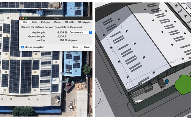
Traditional manual surveys rely on tape measures, guesswork, and physical access creating errors that compound during installation. A drone-based rooftop solar survey replaces all of that with centimetre-level GPS data, high-resolution imagery, and AI-processed 3D models that engineers can directly use in PVsyst and SketchUp.

For factories, warehouses, commercial buildings, and large industrial rooftops, an accurate solar site assessment is the difference between a profitable installation and years of underperformance.

Data Deliverables from a Lesoko Survey

Every survey project delivers a complete data package — ready for engineering, DISCOM approvals, and EPC planning.

Industry Problem

Why Solar Survey Is Critical Before Installation

Most rooftop solar underperformance isn’t a panel quality problem. It’s a planning problem. Here’s what gets missed when projects skip a proper solar feasibility study.

Roof structure not assessed for solar load

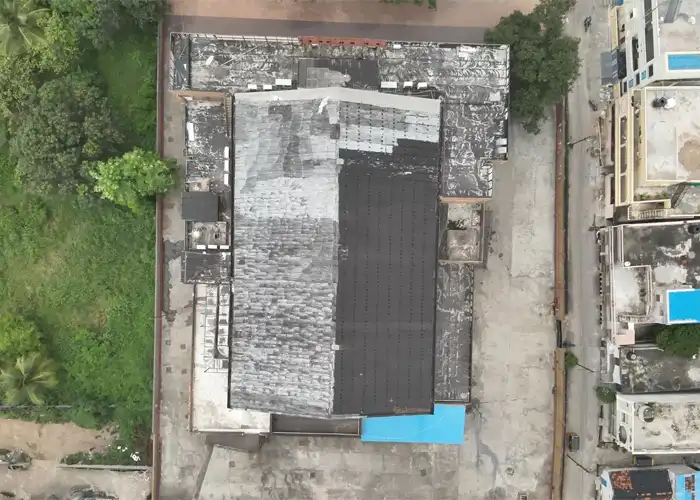
Industrial roofing in India varies from RCC slabs to old Mangalore tiles to lightweight sheet structures. Without a structural analysis for solar panels, installations risk roof damage or failure under panel weight and wind loads.

Shadow impact on solar panels ignored

Adjacent buildings, water tanks, chimneys, and trees cast shadows that change by season and time of day. Unaccounted shadow analysis for solar rooftop systems leads to 20–40% lower energy yields than projected.

 
Drone inspecting solar panels on a rooftop for accurate solar rooftop survey and structural safety assessment in India
Drone capturing roof data for solar rooftop survey and solar panel installation planning on a commercial building in India

Inaccurate measurements lead to wrong system sizing

Manual measurements miss roof obstructions, undulate surfaces, and irregular layouts. Inaccurate solar planning means undersized or oversized inverters, wrong cable lengths, and installation rework costs.

No visual data for engineers and EPC teams

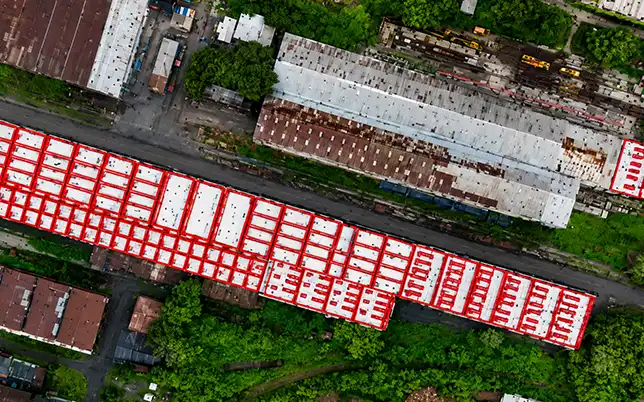
EPC teams need georeferenced layouts, not rough sketches. Without an orthomosaic map and point cloud, engineers can’t do precise solar panel layout optimization wasting usable roof area.


Physical survey access risks and delays

Manual survey teams on industrial rooftops face real safety risks, especially on sloped or fragile sheet roofs. Lesoko drones eliminate rooftop access risks entirely, surveying large areas in hours instead of days.

Poor solar ROI from avoidable design errors

Every planning error that slips through an inadequate survey compounds into reduced solar energy generation, missed subsidy targets, and poor return on a significant capital investment.

 
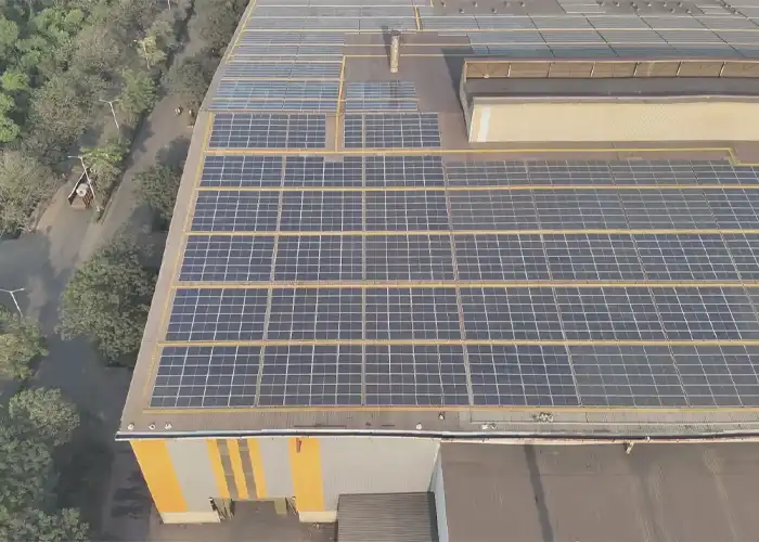
Aerial view of solar panels on a rooftop being surveyed by drone for performance assessment and installation planning in India

Drone-Based Solar Rooftop Survey Solutions

Lesoko’s drone-powered survey process captures, processes, and delivers engineer-grade data for every rooftop solar project — from a single 500 sqm commercial terrace to a 10-acre industrial complex.

Building Feasibility Study

rooftop solar feasibility study evaluates whether the structure can physically and economically support a solar installation. Our drones capture complete geometric and structural surface data to determine viable installation zones.

2D / 3D Roof Mapping

Our high-resolution drone flights generate orthomosaic maps, digital elevation models, and full 3D rooftop mapping including SketchUp and point cloud deliverables — directly usable by your engineering and design teams.

Shadow Analysis Simulation

Lesoko’s time-based shadow analysis simulation models how obstacles — tanks, parapets, adjacent structures, trees — cast shadows on your roof across every hour of the year. Inputs are PVsyst-ready for accurate energy yield simulation.

Solar PV Module Measurement & Layout

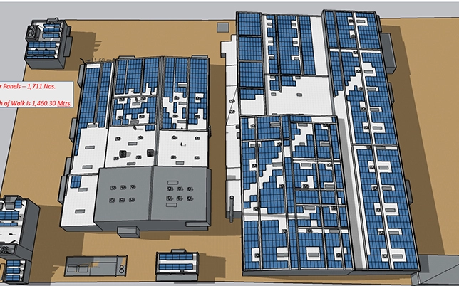
Precise solar PV module measurement and layout planning using drone data eliminates guesswork. Our team maps optimal panel rows, inter-row spacing, and cable routing paths based on actual roof geometry.

Why Better Site Data Compounds Across Every Phase

The downstream value of quality drone survey for wind farm data reaches every project phase — from bid preparation through construction and financial closure.

Structural Member Detection

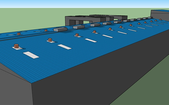
Our sheet profile analysis identifies purlin and rafter positions, spacing, and load capacity data enabling engineers to specify correct mounting systems without a single manual measurement on-site.

Obstacle Identification & Clearance

Every rooftop object — AC units, vents, skylights, water tanks, telecom equipment is identified and mapped in the 3D model with exact coordinates, enabling accurate exclusion zones and cable routing in your design software.

Solar Layout Planning Support

From the drone data, Lesoko generates optimal solar panel layout plans maximising installed capacity while respecting structural limitations, fire safety clearances, maintenance walkways, and MNRE guideline setbacks.

PVsyst-Ready Scene Files

Our 3D models export directly as PVsyst horizon and near-shading scenes eliminating the hours EPCs typically spend reconstructing rooftop geometry manually in simulation software.

GIS & Georeferenced Outputs

All drone outputs are georeferenced meaning your project data integrates with GIS platforms, satellite basemaps, and government solar rooftop portals for DISCOM submissions and net metering applications.

Rapid Turnaround, Remote Delivery

Surveys are typically completed in a single site visit. Processed data packages are delivered digitally within 3–5 business days, enabling faster project approvals and reducing your pre-sales cycle time significantly.

Business Value

Benefits of a Professional Solar Rooftop Survey

The survey is an upfront investment that pays back across the entire project lifecycle — from design through installation through 25 years of energy generation.


Maximise energy generation

Optimal panel placement based on real shadow and orientation data increases annual energy yield by 15–25% versus guesswork layouts.

Reduce installation errors

Accurate dimensions and structural data eliminate costly rework during installation no surprise obstructions, no wrong mounting specs.

Improve project ROI

Better system sizing, accurate yield projections, and reduced rework costs directly improve the financial return on your solar investment.

Faster DISCOM approvals

Georeferenced outputs and structured reports speed up net metering applications and DISCOM technical approvals across all Indian states.

What You Get from Every Solar Rooftop Survey

Every Lesoko solar rooftop survey includes a complete data package — not just images. Eleven design-ready deliverables, all geo-referenced, in multiple export formats.

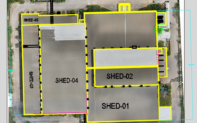
A geo-referenced orthomosaic map from Lesoko's drone solar rooftop survey — providing a precise, stitched 2D aerial image of the complete rooftop used for panel layout planning and usable area calculation.

Orthomosaic Map

A geo-referenced, stitched 2D aerial image of the complete rooftop — accurate to sub-centimetre level — used for precise panel layout planning and usable area calculation.
2D and 3D rooftop models from drone solar rooftop survey showing building structure for solar panel installation planning in India

2D / 3D Rooftop Models

Precise digital models of your roof including every beam, support, obstacle, and surface feature — enabling engineers to plan panel placement with exact structural context and no surprises on installation day.
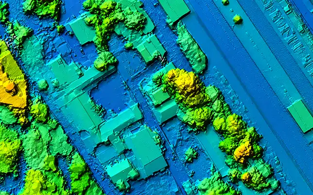
Digital elevation model from drone solar rooftop survey showing precise surface height data for solar mounting system design and drainage planning in India

Digital Elevation Model (DEM)

Precise surface elevation data of the entire roof — revealing slope, tilt, and height variations critical for mounting system design, drainage planning, and inter-row shading calculations.
Contour map from drone solar rooftop survey showing roof gradient and surface elevation for solar panel tilt angle planning in India

Contour Maps

Topographic contour data identifying roof gradient and surface undulations — essential for uniform panel tilt angles, correct mounting heights, and row-spacing optimisation across uneven rooftops.
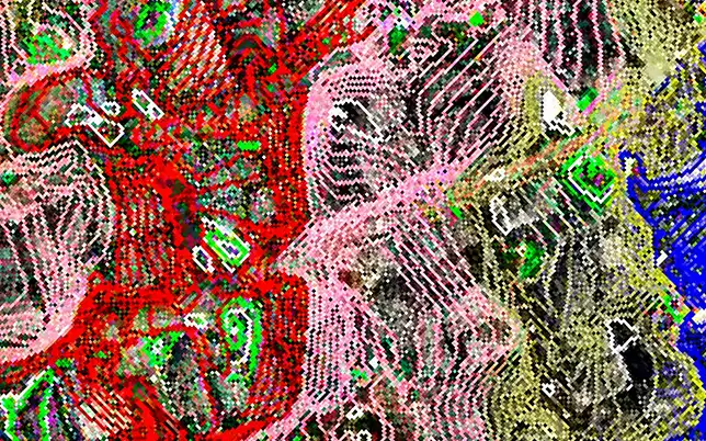
Point cloud data from drone solar rooftop survey showing dense 3D surface model of rooftop for structural analysis and solar installation planning in India

Point Cloud Data

Dense 3D point cloud of the rooftop surface — providing the raw photogrammetric data for advanced structural analysis, obstacle height measurement, and import into specialist solar design and GIS tools.
SketchUp and CAD-ready 3D models from drone solar rooftop survey showing solar panel layout on building roof for design-ready export in India

SketchUp / CAD-Ready Models

Design-ready 3D models directly importable into SketchUp, AutoCAD, and PVSyst — eliminating remodelling from scratch and enabling your design team to begin work immediately on receipt of the report.
Aerial photos and videos from drone solar rooftop survey showing complete rooftop overview and site context for client reporting and documentation in India

Aerial Photos & Videos

High-resolution aerial photographs and video footage of the complete rooftop — providing a visual site record for client presentations, progress documentation, and stakeholder reporting alongside the technical data outputs.
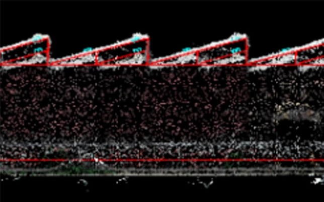
Sheet profile analysis from drone solar rooftop survey showing metal sheet roofing structure and purlin spacing for solar mounting system selection in India

Sheet Profile Analysis

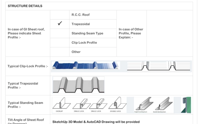
Detailed profiling of metal sheet roofing — identifying sheet type, purlin spacing, ridge orientation, and structural geometry. Essential for selecting the correct solar mounting clamps and ensuring a structurally sound, warranty-compliant installation on metal sheet rooftops.

Why drone monitoring is superior

The Monitoring Gap: Traditional Methods vs. Lesoko

Most wind projects still rely on contractor-reported progress, periodic site visits, or in-house EPC tracking teams. Each approach carries structural blind spots that drone-based monitoring eliminates.

Lesoko drone advantage
Traditional / manual limitation
Capability Traditional / Manual Lesoko Drone Monitoring
Site coverage per visit ✕ Spot checks / sampling only ✓ 100% site coverage per flight
Real-time visual evidence ✕ Not available ✓ 4K drone video + orthomosaic
L2 schedule integration ✕ Manual / subjective estimate ✓ Actual vs planned comparison
Dispute documentation ✕ No timestamped proof ✓ GPS + time-stamped records
Multi-site tracking ✕ Not scalable ✓ Consolidated multi-site reports
Remote accessibility ✕ Physical presence required ✓ Reports delivered digitally
Data formats ✕ Word / Excel reports only ✓ PDF, GIS, KML, video, DEM
Measurement accuracy ✕ ±5–30cm, operator-dependent ✓ <1cm GPS precision

Solar Rooftop Survey Services Across India

From large-scale ground-mounted farms in Rajasthan and Gujarat to commercial rooftop installations across Tamil Nadu, Karnataka, and Maharashtra — Lesoko’s drone inspection teams are deployed nationwide.

Every state has its own inspection demands. Rajasthan and Gujarat see extreme dust accumulation, making bi-annual thermal inspections essential to prevent 15–20% output losses. Tamil Nadu and Karnataka have rapidly growing rooftop solar capacity that needs regular post-monsoon fault clearance. Maharashtra and Telangana host large C&I portfolios where even a 1% output drop across multiple sites represents significant revenue loss.

Our DGCA-certified teams operate across all major solar corridors covering utility-scale IPPs, EPC handover inspections, and commercial rooftop O&M contracts in every region.

Drone solar rooftop survey services coverage map across India showing all major solar states

Solar Rooftop Survey for Every Stakeholder

How Often Should a Solar Rooftop Be Inspected?

Once your solar rooftop is installed, regular inspection maintains peak performance and catches faults before they cause generation losses that run for years. The standard recommendation is at least one drone inspection per year for all installed solar rooftops.

Soiling alone can reduce output by 15–20% between washes. Bi-annual inspections are strongly recommended for these regions. Post-monsoon inspections are critical across all states. Storm damage, hail impact, bird droppings, and moisture ingress accumulate during the monsoon season and may not trigger SCADA alerts until significant generation losses have already occurred. A post-monsoon drone inspection catches all of this before it affects your next quarter’s output.

Trusted By Industry leaders

What Solar Operators Say About Our Rooftop Surveys

hind

“Lesoko’s solar rooftop survey saved us an entire week of site revisits. The 3D model and shadow analysis were exactly what we needed to finalise the panel layout for a complex industrial shed rooftop. Report delivered in 36 hours.”

 
Rated 5 out of 5
Solar EPC Contractor · Maharashtra Project Manager ·
eneroarc

“We used to send workers onto rooftops for site surveys — always a concern on old industrial buildings. Lesoko’s drone survey is faster, safer, and gives us far more design data than we were getting before. It’s now standard on every project.”

 
Rated 5 out of 5
Renewable Energy Developer · Tamil Nadu Site Engineer ·
teqo copy

“The building feasibility report identified a structural issue on one roof section before we’d ordered any panels or mounting hardware. That single finding from the rooftop survey saved us from a very expensive installation mistake.”

Rated 5 out of 5
Asset Management Firm · Gujarat O&M Head ·

Why Choose Lesoko

India's First Drone-Based Solar Survey Company

Lesoko is not a solar EPC that added a drone. We are a drone data company that has built deep solar domain expertise over thousands of site surveys across India.

0 +

Solar projects inspected

0 Lak+

Safe flights completed

0 Ha

Survey area covered

0 M+

Monitoring costs saved

Sub-centimetre accuracy

GPS-tagged drone data at <1cm precision, processed through industry-standard photogrammetry pipelines. Not surveyor estimates.

Engineer-ready deliverables in 3–5 days

Your engineering team receives PVsyst-ready 3D scenes, AutoCAD plans, and shadow simulation outputs.

PAN India drone operations

Active teams across Tamil Nadu, Maharashtra, West Bengal, Bihar, Gujarat, Rajasthan and more. Multi-site programs welcome.

Proven at scale with India's largest EPCs

Worked with L&T, Sunedison, Enerparc, Amplus, Refex Energy, and government bodies across programs totalling 3.5GW+.

Solar Rooftop Survey Use Cases in India

Lesoko has surveyed every rooftop type from 500MW government programs to single factory buildings. Our workflow adapts to your project size and complexity.


Industrial Factories & Manufacturing Units

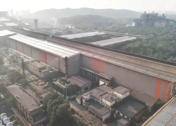
Large shed rooftops with north-light or A-frame profiles, multiple structural bays, and rooftop HVAC systems. Drone surveys capture complete geometry in a single flight including all obstacles and structural member positions for mounting design.

Commercial Buildings & IT Parks

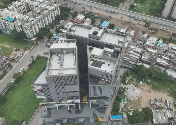
Multi-level terraces, complex setback requirements, diverse rooftop equipment. Commercial rooftop solar feasibility studies need precise usable area calculations to justify investment to building management committees.

Warehouses & Logistics Parks

Among India's most solar-viable asset class large flat or low-slope roofs with minimal obstructions. Lesoko surveys help logistics companies accurately estimate capacity and secure EPC contracts faster.

Government & Institutional Buildings

Schools, hospitals, government offices under PM Surya Ghar and state RESCO programs. Lesoko has worked with WBREDA, BREDA, and MEDA on large multi-site survey programs requiring standardised deliverables.

Solar Rooftop Survey Cost & Packages in India

Fixed packages by system size. No hidden costs. Survey quote within 24 hours. Survey + inspection combination packages available.


Small Rooftop

10 kW – 50 kW rooftop systems
  • 🔸Drone RGB aerial survey flight
  • 🔸2D orthomosaic map
  • 🔸Roof area measurements & panel count
  • 🔸Shadow & shading analysis
  • 🔸Report delivered in 48 hours
  • 🔸DGCA-compliant operations

C&I Rooftop

50 kW – 10 MW commercial
  • Full drone survey + RGB data capture
  • 2D & 3D rooftop models
  • Orthomosaic + DEM + contour maps
  • Detailed shadow & shading analysis
  • Building structural feasibility report
  • Solar PV module capacity measurements
  • SketchUp / AutoCAD compatible exports
  • Client dashboard access and PDF + Excel + GIS + image exports

Multi-Site Contract

Multiple rooftops & annual contracts
  • 🔸Annual or bi-annual survey scheduling
  • 🔸Volume pricing for multiple sites
  • 🔸Priority dispatch & fast turnaround
  • 🔸Trend analysis across inspections
  • 🔸Dedicated account manager
  • 🔸Survey + thermal inspection combo
  • 🔸Multi-format delivery + dashboard
Rooftop solar survey shadow analysis report showing how building shadows fall on solar panels during the day for optimised installation planning in India
Solar rooftop panel survey report on Lesoko client dashboard showing installation data and performance analysis for solar project planning in India
3D model of a solar rooftop system with solar panels installed on a house roof generating clean energy from sunlight
Shadow analysis of solar rooftop showing sunlight direction and shading impact on solar panels for better energy output

Every solar rooftop survey includes access to our secure cloud-based client dashboard giving solar EPCs, developers, and asset managers instant access to all survey data, models, reports, and recommendations from any device.

Dashboard Features

  • Secure role-based login for your team and clients
  • Geo-tagged rooftop data on interactive maps
  • 2D/3D models with interactive measurement overlays
  • Shadow analysis visualisation with time-of-day slider
  • AI-driven recommendations for panel placement optimisation
  • Download PDF, Excel, GIS, CAD, and raw image export

Data Security

All survey data is securely stored and accessible only by authenticated users, following DGCA and ISO data security standards. Your site data is never shared.
 

Get Your Solar Rooftop Survey Quote in 24 Hours

Free · No obligation · Quote in 24 hours
 

Phone/ Whatsapp

+91 78457 26375/ 7845726374

Email Us

sales@lesoko.in

Head Office

T. Nagar, Chennai, Tamil Nadu 600017
 

Request Solar Rooftop Survey Quote

Frequently Asked Questions

solar rooftop survey is a technical site assessment that evaluates a building’s roof for solar panel installation. It covers available roof area, structural load capacity, orientation, shading from nearby objects, and surface geometry. A professional survey provides engineers and EPC teams with the data needed to design an optimal, code-compliant photovoltaic system.
 

Without an accurate survey, solar installations face wrong panel counts, incorrect mounting designs, shading losses, and structural failures. A drone rooftop survey measures usable roof area, identifies obstacles and shading patterns, assesses structural load capacity, and produces design-ready models — preventing costly rework after installation begins.

Shadow analysis simulates how adjacent buildings, chimneys, water tanks, and rooftop structures cast shadows on panels throughout the year. In India’s diverse urban environments, unaccounted shading can reduce annual energy yield by 20–40%. Lesoko’s time-based shadow simulation runs across every hour of the year at your site’s latitude — giving PVsyst the accurate inputs it needs for reliable yield forecasting.
Solar rooftop survey cost in India varies based on roof area, complexity, number of buildings, and required deliverables. Lesoko offers competitive, project-specific pricing for drone surveys that include full data packages (3D models, shadow analysis, engineering reports). For a custom quote for your factory, commercial building, or multi-site program, contact our team directly.

The on-site drone flight takes 30 minutes to 2 hours depending on roof size and complexity. Processed deliverables — including all 2D/3D models, shadow analysis, and the final report — are ready within 48 hours of the site visit.

Technically possible, but a significant financial risk. Without a solar site assessment, you risk incorrect system sizing, structural damage from overloading, poor energy yield from unaccounted shading, and installation rework costs that can exceed the survey fee many times over. For industrial and commercial projects above 50kW, a professional solar survey is essential — and often required by EPCs and financiers.

A standard industrial rooftop (5,000–20,000 sq ft) is typically surveyed in a single day’s flight mission. Data processing, 3D modelling, shadow simulation, and deliverable preparation takes 3–5 business days. Compare this to 2–4 days of on-site manual survey plus additional weeks for processing and re-measurement.

Yes. Lesoko has PAN India drone operations with teams deployed across Tamil Nadu (headquartered in Chennai), Maharashtra, West Bengal, Bihar, Gujarat, Rajasthan, and other states. We support multi-site survey programs for EPCs and government bodies, with standardised deliverables across all locations.
 

Lesoko provides solar rooftop survey services across India including Tamil Nadu, Maharashtra, Rajasthan, Gujarat, Karnataka, Telangana, Andhra Pradesh, and Kerala. Key cities covered include Chennai, Mumbai, Pune, Jaipur, Ahmedabad, Bengaluru, Hyderabad, and Kochi. Contact us for project availability in your location.

Yes. Lesoko’s survey deliverables including the building feasibility report, shadow analysis, and CAD-ready 3D models are accepted by solar EPCs, DISCOM authorities, and financial institutions for project approval, net metering applications, and loan documentation. The reports meet IEC and DGCA documentation standards.

Scroll to Top