
Drone Inspection Services India — Solar, Wind & Transmission
India’s energy and infrastructure base now spans 75+ GW of solar capacity, 4.75 lakh circuit-kilometres of transmission lines, and thousands of operational wind turbines all requiring systematic, documented inspection at scale. Manual methods cannot meet that demand within a single maintenance window. Lesoko Technologies provides DGCA-certified, pan-India UAV inspection and aerial survey services across all major industrial verticals from a single vendor relationship.
35 GW+
Solar Assets Inspected
5,00,000+
Safe Flights — Zero Crashes
2.3+ lakh
Hectares Surveyed
210+ Cr
Saved in Operational Costs
<1 cm
Level Accuracy — Survey Operations
Overview
What Are Drone Inspection Services?
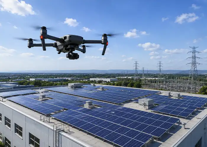
Drone inspection services use UAVs (unmanned aerial vehicles) to conduct aerial survey, defect detection, and condition assessment across industrial, energy, and infrastructure assets. Depending on the vertical, platforms carry radiometric thermal sensors for solar and wind applications, high-resolution RGB cameras for visual structural assessment, LiDAR for transmission corridor mapping, or multispectral sensors for vegetation and land survey. The output is geo-tagged, documented data not a manual inspection report.
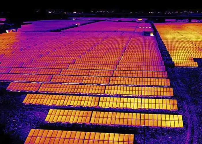
UAV inspection replaces rope access, scaffolding, ground-level surveys, and shutdown-dependent manual methods. A 60 MW solar plant that would require weeks of manual ground survey can be inspected in 36 hours by a drone team with module-level defect mapping, radiometric TIFF deliverables, and a client-accessible digital report. For procurement managers evaluating drone inspection for the first time, the practical distinction is this: drone inspection delivers asset-level data at portfolio scale without the access constraints that limit what manual teams can physically reach or safely assess. For further background on UAV inspection applications in Indian industry.
The Inspection Challenge
Why India's Industrial Assets Cannot Rely on Manual Inspection
India operates over 75 GW of installed solar capacity, 4.75 lakh circuit-km of transmission lines, and thousands of wind turbines all requiring regular, documented inspection under O&M contracts, lender technical audits, and EPC handover requirements. Manual inspection methods require shutdowns, scaffolding, rope access, or extended ground-level surveys that cannot cover large assets within a single maintenance window. Delayed defect detection compounds performance losses in ways that do not surface in generation data until yield has already dropped significantly.
Lender technical auditors, EPC handover processes, and O&M contracts increasingly require geo-tagged, component-level or module-level documentation not handwritten site notes. Multi-site asset owners managing portfolios across several states often rely on different vendors per site, which creates data format inconsistencies that complicate asset management at the portfolio level. A pan-India vendor with consistent methodology, DGCA-compliant certified pilots, and standardised reporting reduces procurement overhead and eliminates data quality risk across the portfolio.
Services by Vertical
Drone Inspection Services by Vertical
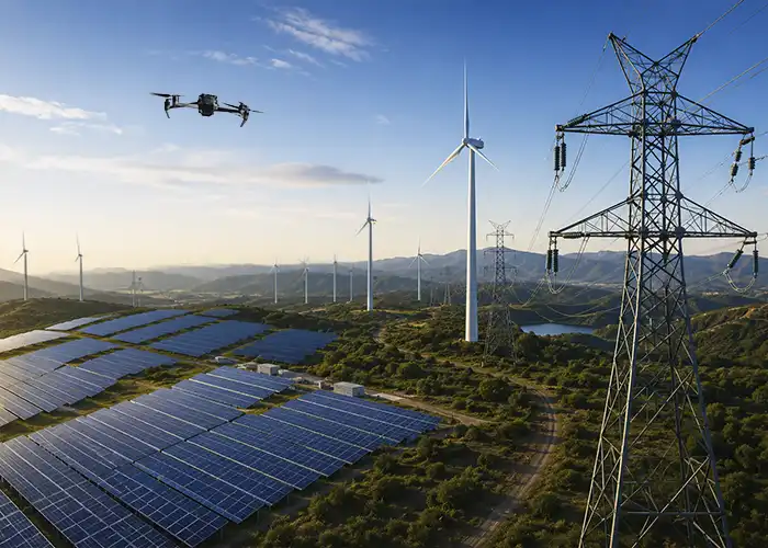
Lesoko provides DGCA-certified drone inspection and aerial survey services across three active industrial verticals, with additional sectors in active expansion. Each vertical has a dedicated flight methodology, sensor configuration, and reporting standard.
Solar Power Inspection
Aerial thermography, ground mount survey, rooftop feasibility mapping, and night surveillance for solar PV assets from 600 KW rooftop systems to 60 MW+ ground mounts. Covers hotspot detection, soiling analysis, diode failure identification, and module-level defect mapping with radiometric TIFF deliverables.
Wind Energy Inspection
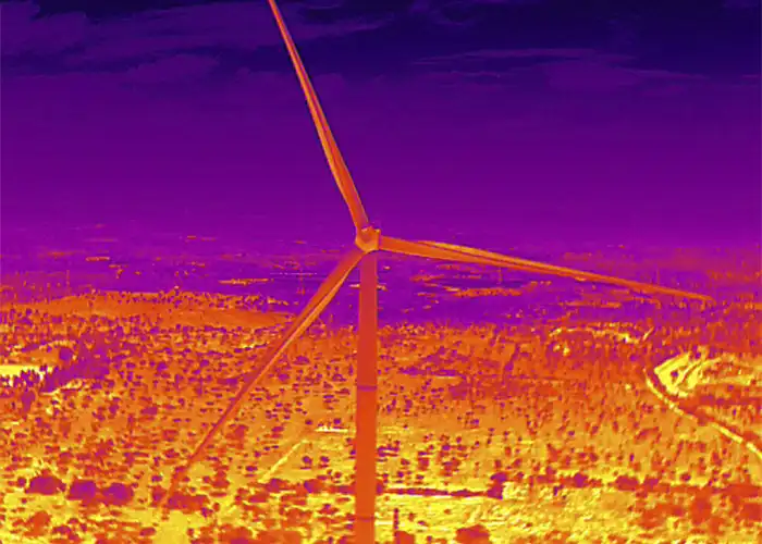
Blade surface inspection for crack detection, leading-edge erosion, and delamination identification. Thermographic turbine inspection and wind farm survey including terrain mapping and access route planning, suitable for onshore wind farms during scheduled maintenance windows.
Transmission Line Inspection
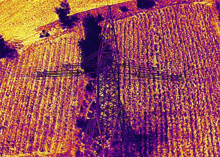
Component-level and span-level inspection of transmission towers, equipment, and cable lines from 33 kV to 765 kV. Covers visual inspection of cross arms, insulators, vibration dampers, jumpers, and foundation access points with observation and recommendation reports per tower.
Process
How a Drone Inspection Engagement Works
From initial project scoping to report delivery, every engagement follows a defined six-step process with vertical-specific branching at sensor selection and flight execution.
Project Scoping
Vertical-specific consultation covering asset type, MW capacity or circuit-km, inspection depth, reporting format, and timeline. Sites above 10 MW qualify for deployment within 48–72 hours.
Regulatory Clearance
DGCA-compliant flight permissions, airspace approvals, and site safety assessment managed per project eliminating the regulatory overhead that clients would otherwise handle independently for each new vendor.
Sensor Configuration
Radiometric thermal sensors for solar and wind applications. RGB and thermal combinations for structural and blade inspection. LiDAR for transmission corridor mapping. Sensor selection is driven by defect type, not default configuration.
Flight Execution
DGCA-certified in-house pilots operate with mission-specific protocols low-altitude grid-pattern flights for solar surveys, proximity flying at 30–60 metre heights for transmission tower and turbine inspection. Thermal surveys are timed for irradiance windows above 600 W/m² to avoid underreporting hotspot severity.
Data Processing
Orthomosaic generation, radiometric correction, point cloud processing where applicable, and AI-assisted defect identification validated by in-house engineers before any report is finalised and delivered. No raw data hand-off without expert review.
Report Delivery
Geo-tagged defect reports, maintenance prioritisation sheets, KML files, Excel defect records, and client dashboard access via the Lesoko portal at lesoko.com. Defect assignments and resolution tracking are live within the portal.
Technical Methodology
Sensor Selection, Data Quality, and Cross-Regional Expertise
Sensor selection is vertical-driven, not default-applied. Solar inspections use radiometric thermal cameras producing calibrated temperature-difference maps at module level. Wind blade surveys combine high-resolution RGB cameras with thermal imaging to detect surface erosion, delamination, and sub-surface structural anomalies in a single flight pass. Transmission line mapping uses LiDAR for corridor profiling and clearance measurement where vegetation encroachment is the primary concern. Survey operations achieve sub-centimetre accuracy (<1 cm level) using ground control point networks and post-processing corrections.
Processing follows a structured QA workflow: orthomosaic generation, radiometric correction, and point cloud processing are completed before AI-assisted anomaly detection runs on the corrected dataset. Every defect flag is reviewed by an in-house engineer before appearing in the client report ensuring that a thermal anomaly caused by module soiling is not reported with the same priority classification as a confirmed cell-level hotspot or bypass diode failure. All project data is accessible in real time through the proprietary client portal at lesoko.com, covering defect tracking, assignment management, and report download.
Compliance & Safety
DGCA Compliance and Operational Safety Record
All Lesoko drone operations are conducted under DGCA commercial certification per Civil Aviation Requirements (CAR). Flight permissions, airspace approvals, and regulatory clearances are managed per project by the in-house team not delegated to the client. For procurement teams, in-house DGCA compliance means reduced client liability exposure and a clear audit trail for lender technical assessors and insurance reviews, which increasingly require documented operator certification.
Lesoko has completed 4,00,000+ safe commercial flights with zero recorded crash incidents across all verticals. Site risk assessments, PPE protocols, and vertical-specific emergency procedures are applied before every mission. Full liability insurance is included with every inspection engagement, and NDA options are available for sensitive site data industrial facilities, military-adjacent infrastructure, or pre-acquisition assets requiring confidentiality.
Deployment Coverage
Pan-India Deployment Across All Active Verticals
Pan-India deployment for all inspection verticals. DGCA-certified pilots are available across Tamil Nadu, Karnataka, Gujarat, Rajasthan, Maharashtra, Andhra Pradesh, Telangana, Jharkhand, and Odisha. Sites above 10 MW qualify for deployment within 48–72 hours. Confirm specific state availability with the operations team for non-listed locations.
Solar
Tamil Nadu (Kamuthi cluster), Rajasthan (Bhadla), Karnataka (Pavagada), Gujarat (Charanka), Andhra Pradesh (Kurnool)
Transmission
Pan-India — 3,575+ km inspected across multiple states. Component and span inspection available anywhere with DGCA clearance.
Wind
Tamil Nadu coast, Gujarat, Rajasthan, Andhra Pradesh — onshore farm coverage with terrain mapping and site access survey.
Procurement Differentiator
Inspection Data Delivered via Proprietary Client Portal
After every inspection, project data is accessible through the Lesoko client portal at lesoko.com — a centralised dashboard covering solar thermal projects, transmission line inspections, and monitoring operations. Clients do not wait for a PDF; the data is live, navigable, and actionable within the portal from day one of delivery.
Solar Thermal Dashboard
Total defects, capacity affected, panel type, and resolution status across all solar projects. Per-project drill-down with defect distribution charts and site-level summary view.
Transmission Line Dashboard
Tower list with component-level defect status, span data, KM covered, and observation-and-recommendation records per tower. Filterable by defect type, criticality, and group.
Inspection Map
RGB, thermal, and grayscale views with panel-level geo-tagging for solar projects. Interactive tower map with attention and defective tower markers for transmission projects.
Report Generation
Customised Excel and PDF reports on demand with defect type, criticality rating, assignment status, observation, and recommendation per component or panel. Download access for all deliverables from within the portal.
Defects found in
recent inspections
Data drawn from the Lesoko Solar Panel Inspection Brochure 2026. All percentage figures represent share of total plant capacity affected.
600 KW Rooftop
1,430 Modules
60 MW Ground Mount
1,90,476 Modules
31.4 MW — Seven Defect Types
98,125 Modules
Pricing Guidance
What Determines Drone Inspection Cost
Pricing for drone inspection services varies significantly by vertical and project scope. The key cost drivers are asset size (MW, turbine count, circuit-km, or site area), inspection depth (standard documentation versus forensic-level component analysis), terrain complexity, urgency, and the reporting format required by the client or lender.
For solar, the primary variables are module count and terrain. For transmission, it is circuit-km length and component inspection depth per tower. For wind, it is turbine count and the degree of close-proximity blade documentation required. For mining and infrastructure, it is site area and data type photogrammetric survey versus persistent surveillance.
Inspection cost should be evaluated against the operational risk of delayed detection. A 60 MW asset inspected in 36 hours by a certified drone team would require weeks of manual ground survey with associated shutdown costs, personnel mobilisation, and incomplete documentation at the end. Contact us with your asset type, capacity, and location to receive a scoped project proposal without obligation.
Solar Panel Inspections Video Coverage
Our Amazing Clients






















Request a Drone Inspection Proposal for Your Assets
Phone/ Whatsapp
+91 78457 26375/ 7845726374
Email Us
sales@lesoko.in
Head Office
Request a Proposal
Frequently Asked Questions
Drone Inspection Services India
Lesoko provides DGCA-certified drone inspection services across solar power, wind energy, and transmission lines with additional services for railways, mining, and infrastructure in active rollout. Currently active services include aerial thermography, blade inspection, transmission tower and component inspection, ground mount and rooftop solar surveys, LiDAR-based corridor mapping, and project progress monitoring. All services are executed by in-house DGCA-certified pilots with full liability insurance included.
Yes. All Lesoko pilots hold DGCA certification for commercial drone operations under Civil Aviation Requirements (CAR). Every inspection is executed by in-house certified pilots no subcontracting at any project stage. Full liability insurance coverage is included with every engagement. Lesoko has completed 4,00,000+ safe commercial flights with zero recorded crash incidents, which can be referenced in procurement and audit documentation.
Currently deployed across solar power (35 GW+ inspected), wind energy, and power transmission (3,575+ km inspected). Clients include Tata Power, ReNew Power, Larsen & Toubro, Sterling & Wilson, Sgurr Energy, and TNEB. Railways, mining, oil & gas, infrastructure, warehouse inventory, and telecom verticals are in active expansion. Contact us to discuss readiness for your specific vertical and state.
Yes. All Lesoko inspection projects are accessible via the proprietary client portal at lesoko.com. Clients can track defects, view inspection maps in RGB and thermal views, assign remediation tasks, set priority levels, generate custom Excel and PDF reports, and monitor resolution status without waiting for email delivery. The portal covers solar thermal projects, transmission line inspections, and monitoring operations with project-level drill-down for each vertical.
Deliverables vary by vertical. Solar inspection outputs include radiometric TIFF thermal maps, high-resolution orthomosaics, KML geo-data, and Excel defect sheets. Transmission inspection outputs include component-level observation and recommendation reports, tower list exports, and customised Excel reports filterable by defect type and criticality. Survey operations include LiDAR point clouds, DEM models, and contour data. All formats are compatible with GIS, CAD, and major asset management platforms including IBM Maximo.
Yes. Lesoko operates as a single pan-India vendor across states eliminating separate vendor contracts, regulatory clearance cycles, and data format reconciliation per state. A single project scope can cover multiple sites with consistent methodology, standardised reporting, and unified access through the client portal at lesoko.com. This is particularly relevant for IPPs and asset managers with solar portfolios spread across Rajasthan, Karnataka, Tamil Nadu, and Andhra Pradesh simultaneously.
Manual inspection of transmission towers requires rope access or scaffolding at 30–60 metre heights, with significant safety risk, high personnel cost, and output limited to hand-recorded observations. UAV inspection covers substantially more towers per day, produces component-level photographic evidence for each element (cross arms, insulators, jumpers, vibration dampers), and generates GPS-tagged defect reports without any tower shutdown or access restriction. The result is faster coverage, higher defect detection rate, and documentation that satisfies lender and transmission utility audit requirements.
Pan-India deployment within 48–72 hours for sites above 10 MW. For urgent requirements in Chennai, Bengaluru, Hyderabad, Ahmedabad, and Pune, same-day or next-day deployment can be accommodated. Contact us with site location, vertical, and capacity to receive a confirmed deployment window specific to your state and asset size.