
Wind Farm Survey & Planning — Drone-Based Site Selection for India's Wind Corridors
GIS-based land feasibility, topographical, environmental and access route survey engineered to help developers and EPCs place turbines correctly, clear land risk, and move through approvals faster, before a rupee is committed to construction.
±3–5cm
Horizontal Accuracy (RTK/PPK)
2–4 Wks
Survey to Deliverable
20–50×
Value vs Survey Cost
6
Active Wind Corridor States
48 Hrs
RFQ Turnaround
Why Site Data Quality Decides Project Outcomes
Get a Precise Picture of Your Site Before You Commit to It
Planning a wind farm starts long before the first turbine goes up. Lesoko’s GIS-based site selection surveys map land use, ownership, and terrain around a proposed site. So land acquisition constraints and environmental concerns surface early, not mid-negotiation.
Because turbine output depends heavily on wind direction and velocity, we map meteorological data against geospatial terrain data to help you place every turbine for maximum generation, not just legally available land.
Our topographical survey and Digital Terrain Model (DTM) outputs let your team and consultants visualise the site before it’s built identifying ridgelines, slope, and obstacles that hinder wind flow, plus any existing transmission infrastructure that could complicate the grid connection later. This is pre-construction site work distinct from our drone wind turbine inspection service, which covers operational blade, tower, and nacelle inspection after a farm is commissioned. If your project is still at the site-selection or land stage, you’re in the right place.
- DGCA-certified pilots and RPAS-registered UAV fleet across India's wind corridors
- In-house GIS analysts, photogrammetry engineers, and LiDAR processing specialists
- Deliverables compatible with WAsP, WindSim, AutoCAD Civil 3D, ArcGIS and QGIS
- Active survey operations in Tamil Nadu, Rajasthan, Gujarat, Karnataka, AP and MP
- Full DGCA, AAI NOC, and state authority permitting managed on your behalf
"A 10-metre elevation error in a site's terrain model can shift micrositing decisions that affect decades of energy yield. The developer who arrives at pre-bid with high-resolution terrain and land data moves faster, bids more accurately, and closes financing with more confidence."
Our Solutions
Survey & Planning Solutions for Every Site Decision
Four integrated survey disciplines, run as one engagement covering the land, the terrain, the logistics, and the environmental clearance work a wind site needs before construction begins.
🔶 Land Feasibility Survey
Drone-based cadastral overlay, slope analysis, and land-use classification to assess acquisition viability before your team starts on-ground negotiations. Identifies fragmented holdings, unmapped seasonal watercourses, and legal encumbrances that traditional revenue-map interpretation misses.
- Cadastral overlay
- Land-use classification
- Slope analysis
- Encumbrance mapping
🔶 Terrain & Topographical Survey
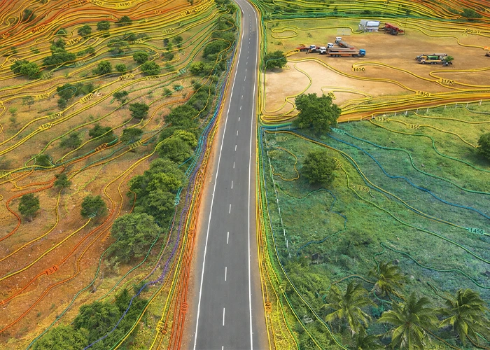
High-accuracy Digital Terrain Models (DTM) and Digital Surface Models (DSM) at 5–10cm GSD, with 1m-interval contour mapping and slope-aspect analysis. Outputs feed directly into WAsP and WindSim for wind flow modelling resolving sub-turbine-height terrain features satellite DEM data cannot capture.
- 3D Corridor Model
- Gradient Profile
- Clearance Analysis
- Route GIS Layer
🔶Access Route Planning
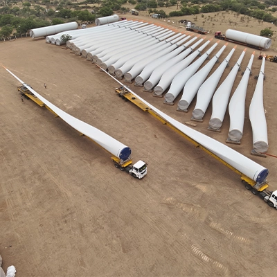
Corridor analysis for WTG component transport — nacelle and blade sweep clearance modelling, bend-radius mapping, and gradient profiling from drone-derived 3D terrain data. We also map existing transmission lines and proposed grid-connection routes to flag obstacles before they become site problems.
- DTM / DSM
- 1m Contours
- LiDAR Point Cloud
- Orthomosaic
🔶 Environmental Impact Mapping
Multi-spectral drone surveys for NDVI-based vegetation mapping, wetland and water body delineation, habitat classification, and CRZ boundary mapping. Delivered in formats directly usable for ESIA reports, MoEFCC submissions, and State PCB consultations.
- 3D corridor model
- Gradient profile
- Clearance analysis
- Route GIS layer
Every Survey Runs Fully Within India's Drone & Environmental Framework
Land and environmental data is only useful if it’s defensible. We manage the regulatory workflow end to end.
DGCA & MoCA Drone Rules 2021
All flights operated by DGCA-certified Remote Pilots on RPAS-registered aircraft, under the Digital Sky framework.
AAI NOC & Airspace Coordination
We manage the complete NOC workflow, including AAI coordination and state authority filings, for every engagement.
CRZ Boundary Mapping
Coastal wind sites are mapped against Coastal Regulation Zone boundaries as part of standard environmental deliverables.
MoEFCC / ESIA-Ready Data
Environmental baseline datasets are formatted for direct use in ESIA reports and MoEFCC clearance submissions.
Our Process
From Mobilisation to Deliverable
Scope definition & flight plan
DGCA NOC & airspace coordination
UAV mobilisation & GCP deployment
Photogrammetry / LiDAR processing
GIS layer generation & QA validation
Deliverable handoff & client review
Why It Matters
Good Site Data Compounds Across Every Project Phase
Precision Micrositing
Accurate terrain models let you place turbines against actual wind shear and wake interaction improving net AEP estimates by 3–8%.
Stronger Lender Due Diligence
Defensible, auditable geospatial datasets give lenders and equity investors confidence in the site data behind your yield forecast.
Reduced Acquisition Risk
Identifying land encumbrances and fragmented holdings before negotiations begin means your team renegotiates from strength, not surprise.
Compressed Timeline
Survey data delivered in 3–4 weeks from mobilisation, versus the 3–4 months typical of equivalent ground survey coverage.
Faster Approvals
Drone-generated environmental baseline data reduces MoEFCC consultation time, and access route surveys prevent costly transport incidents.
Foundation Cost Optimisation
Accurate slope and bearing-capacity mapping reduces WTG foundation over-design across the project.
Survey Data
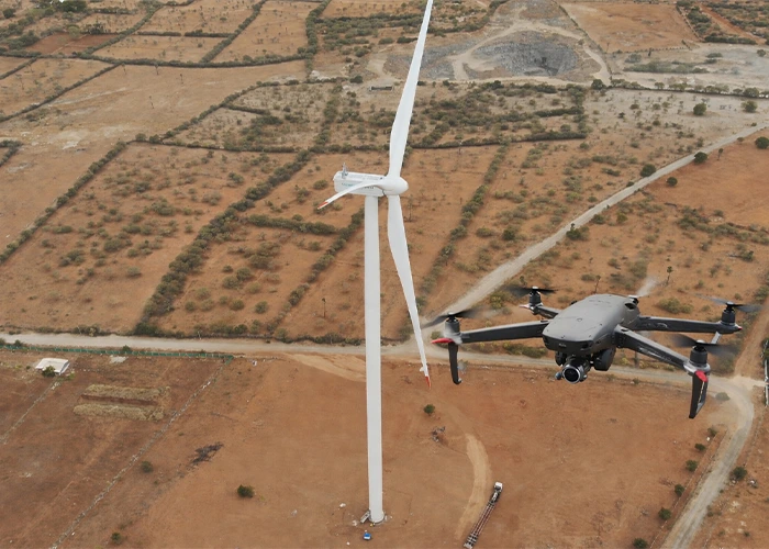
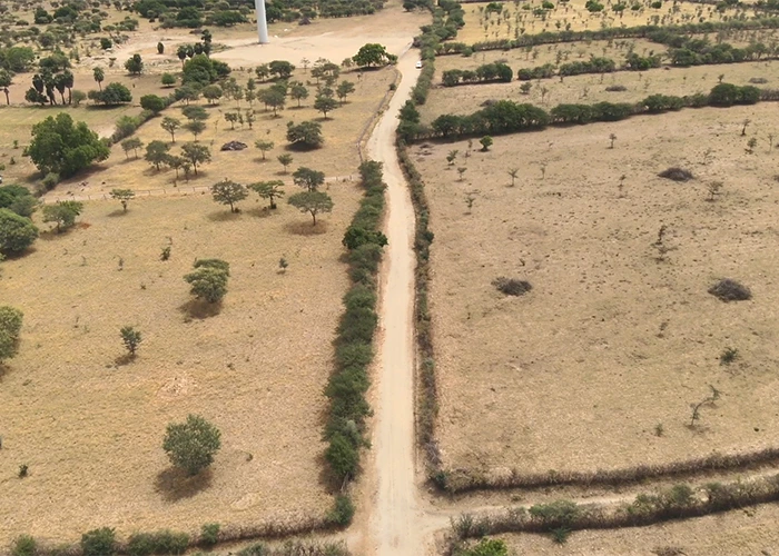
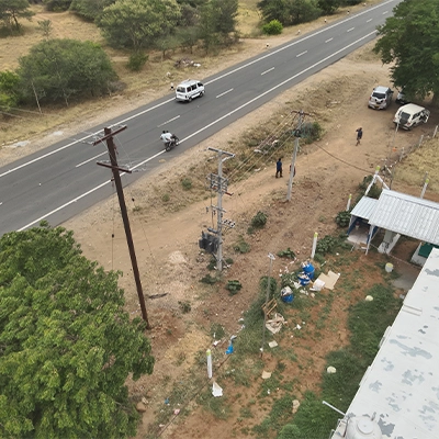
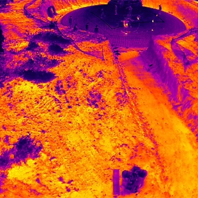
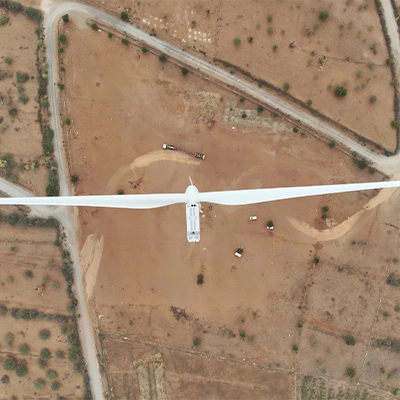
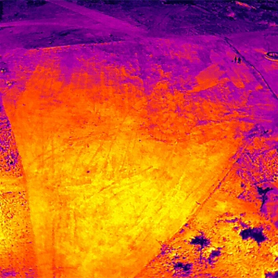
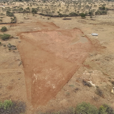
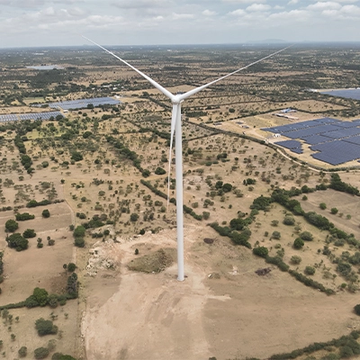
Every image below is captured from an actual Lesoko drone survey flight. This is what your project deliverables look like.
Real-World Engagements Across India
Illustrative scenarios based on the types of survey challenges Lesoko resolves for EPC contractors, wind developers, and project teams across India’s wind energy states.
Ridgeline Turbine Micrositing — Competitive Pre-Bid Survey
An EPC contractor required high-resolution terrain data along a 4.2 km ridgeline to validate turbine spacing and assess wake interaction before committing to a competitive bid. Lesoko completed a 380-hectare LiDAR and photogrammetry survey in 3 days, delivering DTM, classified point cloud, and contour data at 1 m intervals.
Two pad locations identified for relocation, saving an estimated ₹1.2 crore in post-construction foundation correction.
Multi-Village Cadastral Overlay — Land Fragmentation Analysis
A wind energy developer needed to assess land fragmentation across 11 revenue villages before initiating acquisition. Drone-based orthomosaic mapping at 8 cm GSD, overlaid with digitised revenue maps, identified critical encumbrances in 3 villages and flagged an unmapped seasonal nala bisecting two proposed turbine pads.
Land team restructured negotiations 6 weeks ahead of schedule, avoiding two high-risk parcels entirely.
ESIA Baseline Mapping — 50 MW Coastal Zone Project
An IPP engaged Lesoko to generate pre-construction environmental baseline data for a 50 MW project in a CRZ-adjacent zone. Multi-spectral drone surveys mapped NDVI zones, CRZ boundaries, and mangrove extent at 10 cm resolution — data that directly supported the ESIA report submitted to MoEFCC.
Environmental clearance timeline reduced by an estimated 8–10 weeks compared to conventional survey methods.
Drone Survey In Action
Trusted By Industry leaders






















Ready to Survey Your Wind Project Site?
Phone/ Whatsapp
+91 78457 26375/ 7845726374
Email Us
sales@lesoko.in
Head Office
2nd Floor, Chettinad Chambers, P.S.Sivasamy Salai 1st Street, Mylapore, Chennai, Tamil Nadu 600004
Request a Survey Quote
What Wind Developers & EPC Teams Ask Us
It’s a pre-construction survey using UAV-mounted photogrammetry and LiDAR sensors to capture land, terrain, and environmental data for a proposed wind farm site used to assess feasibility, plan turbine placement, and support regulatory clearances before construction begins.
With RTK/PPK GPS and adequate ground control points, drone photogrammetry achieves horizontal accuracy of ±3–5cm and vertical accuracy of ±5–10cm. LiDAR achieves ±2–5cm vertical accuracy even in forested terrain comparable to or better than conventional total station survey for most wind project applications.
Yes. Under the MoCA Drone Rules 2021 and the Digital Sky framework, all commercial UAV operations require DGCA-registered aircraft, certified Remote Pilots, and prior NOC from the relevant airspace authority. Lesoko manages this entire workflow as part of every engagement.
Standard deliverables include high-resolution orthomosaic (GeoTIFF), DTM, DSM, contour lines (DXF/SHP), classified LiDAR point cloud (LAS/LAZ), slope and aspect rasters, and vector GIS layers (SHP/KML/KMZ/GeoJSON) referenced to WGS84/UTM or client-specified coordinate systems.
Field operations for a 300–600 hectare survey typically take 2–4 days of mobilised flying time. Processing, QA, and GIS deliverable preparation adds 5–10 working days. A full engagement — from contract signature to final deliverable, including permitting runs 3–4 weeks. Expedited timelines are available for pre-bid situations.
Micrositing is the process of positioning each turbine within a site to maximise energy capture and minimise wake interaction between machines. Because wind shear at hub height is strongly influenced by terrain features as small as 10–50m, even minor elevation errors in the underlying terrain model can shift micrositing decisions that affect decades of energy yield.
Most Indian wind projects require NDVI vegetation mapping, water body and wetland delineation, habitat sensitivity classification, and for coastal sites CRZ boundary mapping, to support ESIA reports and MoEFCC clearance submissions.
No, the two are complementary. A WRA measures actual wind speed, direction, and shear at hub height over 12–24 months. A drone survey generates the high-resolution terrain data that feeds into the wind flow model used to extrapolate WRA measurements across the full site. Without accurate terrain data, the wind flow model introduces AEP estimation errors.