Did you know the global construction drone market, valued at $5.05 billion in 2023, is projected to reach $15.51 billion by 2032? That rapid growth reflects a major shift in how modern projects are planned and executed. 3D Drone Surveys are quickly becoming the backbone of data-driven construction, yet many contractors still struggle with outdated surveying methods, costly delays, and limited site visibility. Traditional workflows can take weeks, expose crews to safety risks, and leave room for measurement errors that lead to expensive rework.
Having implemented drone-based mapping across infrastructure and commercial developments, I’ve seen firsthand how the right aerial survey strategy can reduce inspection time by up to 60% and dramatically improve project accuracy. In this article, we’ll break down how 3D Drone Surveys work, their measurable ROI, compliance considerations, and best practices for integrating them into construction workflows successfully.
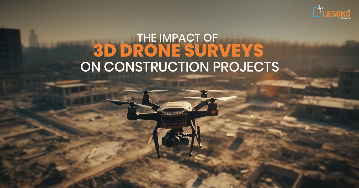
What Are 3D Drone Surveys and How Do They Work in Construction?
In my experience managing large-scale civil projects, 3D Drone Surveys have fundamentally changed how we collect and use site data. At their core, 3D Drone Surveys use unmanned aerial vehicles (UAVs) equipped with high-resolution cameras or LiDAR sensors to capture overlapping aerial images. These images are processed using photogrammetry software to generate accurate 3D models, topographic maps, and point clouds.
On a 200-acre infrastructure project I oversaw, traditional ground surveying would have taken nearly two weeks. Using drones, we completed data capture in under a day and delivered centimeter-level accuracy (around 1 cm) using RTK-enabled systems.
The global construction drone market, valued at approximately $5.05 billion in 2023, is projected to reach $15.51 billion by 2032, reflecting a 13.3% CAGR. This growth is driven largely by demand for faster, safer, and more accurate site insight.
From an operational standpoint, 3D Drone Surveys integrate seamlessly into BIM workflows, improving planning precision and reducing costly rework. When implemented correctly with licensed pilots and proper ground control points they provide reliable, repeatable, and audit-ready data that project stakeholders can trust.
How Accurate Are 3D Drone Surveys Compared to Traditional Land Surveying?

Accuracy is the first question clients ask me when considering 3D Drone Surveys, and rightly so. In professional deployments using RTK or PPK-enabled drones, we routinely achieve centimeter-level accuracy suitable for earthwork calculations, grading plans, and volumetric analysis.
Compared to traditional surveying, drone-based workflows can reduce measurement errors by up to 60%. On one commercial site development, manual surveying required over 1,000 labor hours. Our drone survey was completed in under five hours, and the volumetric results aligned within tolerance when cross-verified with total station data.
That said, expertise matters. Accuracy depends on ground control points, flight planning, and data processing quality. Organizations such as the Federal Aviation Administration (FAA) regulate drone operations in the U.S., ensuring safe integration into airspace. For boundary surveys requiring legal certification, licensed land surveyors must validate results. I always recommend hybrid workflows combining drone data with ground validation for mission-critical measurements.
When executed professionally, 3D Drone Surveys not only match but often exceed traditional methods in efficiency, while maintaining high precision standards required for modern construction projects.
What Are the Benefits of 3D Drone Surveys for Construction Projects?
1. Faster Site Inspections
3D Drone Surveys significantly reduce inspection timelines. In real-world deployments, inspection times are reduced by up to 60% compared to traditional surveying methods. Large infrastructure sites that once required weeks of manual measurement can now be documented in hours, accelerating project schedules.
2. Lower Labor Costs
Labor cost savings typically range from 20% to 30%. By minimizing manual fieldwork and reducing the need for large survey crews, drone-based workflows streamline operations while maintaining high precision standards.
3. Reduced Rework and Higher ROI
Early detection of grading inconsistencies and site deviations prevents costly rework. On highway expansion projects, drone mapping has helped teams avoid six-figure correction costs. Industry case studies report overall ROI improvements between 15% and 25%.
4. High-Resolution Data and Site Visibility
Drone surveys generate:
- Orthomosaics
- Digital Surface Models (DSMs)
- 3D meshes
These deliverables allow stakeholders to visualize site conditions remotely. Approximately 64% of major construction projects now use drones for site insight and safety monitoring.
5. Improved Stakeholder Communication
3D models provide a clear, measurable visual record of site progress. Owners, investors, and project teams can track development in real time, reducing disputes and improving transparency.
6. Faster Decision-Making
The greatest operational advantage lies in decision speed. Workflows that once took weeks now take hours or days, giving project managers actionable intelligence to stay on schedule and within budget.
How Much Do 3D Drone Surveys Cost and What Is the ROI?
Cost discussions around 3D Drone Surveys must consider both upfront investment and long-term return. I’ve seen firms reduce survey costs from approximately $15,000 to $500 per survey by switching to drone-based workflows roughly 75% savings. Traditional survey efforts that once required 1,200 labor hours can now be completed in under five hours. These efficiency gains typically translate into 15%–25% ROI across projects.
However, organizations must account for pilot training, insurance, regulatory compliance, and software licensing. In regions like India, where only about 30% of construction firms currently use drones (compared to roughly 60% in developed markets), adoption barriers often center around initial cost and regulatory clarity.
From a financial perspective, drones pay for themselves quickly on multi-phase or large-acreage projects. The real ROI isn’t just in survey savings it’s in reduced rework, improved planning accuracy, and faster reporting cycles. When evaluating vendors, prioritize experience, certified pilots, and transparent deliverables. A low-cost provider without quality controls can introduce costly errors later.
How Do 3D Drone Surveys Improve Construction Site Safety?
Safety improvements are one of the most compelling reasons we deploy 3D Drone Surveys. In my field experience, drones eliminate the need for surveyors to access hazardous areas such as unstable slopes, active excavation zones, or elevated structures. By capturing aerial data remotely, inspection times are reduced by up to 60%, minimizing exposure to risk. Approximately 70% of U.S. construction projects now use drones for mapping and monitoring, largely due to safety and efficiency benefits.
On a quarry development project, drone inspections replaced manual cliff-face assessments, significantly reducing fall hazards. Beyond hazard avoidance, drones support compliance by providing detailed documentation for safety audits. Advanced drones equipped with AI and machine vision can identify potential safety violations early such as missing guardrails or improper material staging helping prevent incidents before they occur.
Regulatory oversight from aviation authorities ensures safe flight operations. When operated by trained professionals under established safety management systems, drones become a powerful risk mitigation tool. From my perspective, fewer boots in dangerous zones means fewer injuries and that alone justifies the investment.
What Software Is Used to Process Data from 3D Drone Surveys?
Capturing imagery is only half the equation in 3D Drone Surveys—data processing defines the value. Professional workflows rely on advanced photogrammetry and construction integration platforms to convert aerial images into accurate, decision-ready deliverables.
Leading Software Platforms for 3D Drone Survey Processing
The most widely used platforms include:
- Pix4D – Generates orthomosaics, point clouds, digital surface models (DSM), and digital terrain models (DTM) with high photogrammetric precision.
- DroneDeploy – Cloud-based mapping platform supporting automated processing, volumetric analysis, and progress tracking.
- Autodesk Construction Cloud – Integrates drone outputs directly into BIM and CAD environments for design comparison and collaboration.
These platforms transform overlapping aerial imagery into:
- High-resolution orthomosaics
- 3D meshes
- Dense point clouds
- Contour maps
- Digital terrain models
Ground Control and Accuracy Management
In professional deployments, accurate ground control integration is critical to achieving centimeter-level precision (around 1 cm).
Ground Control Points (GCPs) and RTK/PPK workflows ensure:
- Proper georeferencing
- Vertical and horizontal accuracy
- Reduced positional error
Poor processing practices can degrade otherwise excellent field data, making quality control during processing essential.
BIM and CAD Integration
Modern drone processing software integrates directly with BIM and CAD systems, allowing engineers to:
- Compare as-built conditions against design models
- Perform cut-and-fill analysis
- Conduct volumetric tracking
- Verify grading progress
This integration supports data-driven construction decisions and reduces costly rework.
AI-Powered Analytics and Automation
Advanced platforms now include AI-driven analytics that:
- Detect deviations from design plans
- Identify grading inconsistencies
- Automate reporting workflows
- Enhance progress verification
These capabilities contribute to the 15–25% ROI improvements commonly reported in drone-enabled construction projects.
Are 3D Drone Surveys Legally Compliant and Regulated?
Regulatory compliance is non-negotiable in 3D Drone Surveys. In the United States, operators must follow FAA Part 107 rules, including pilot certification and airspace authorization where required. From my professional standpoint, compliance extends beyond aviation law. Survey data used for legal boundaries must be validated by licensed land surveyors. Drones support measurement but legal certification remains a professional responsibility.
Globally, regulatory complexity affects adoption rates. Developed markets report around 60% integration, while some countries lag due to cost and regulatory uncertainty. Proper documentation including flight logs, insurance coverage, and risk assessments protects both contractors and clients. I advise construction firms to partner with certified operators who maintain clear compliance records.
Trust is built through transparency. If a provider cannot demonstrate licensing, insurance, and data validation protocols, reconsider the engagement. Drones are powerful tools but only when operated within established legal frameworks.
How Long Does It Take to Complete a 3D Drone Survey?
Time efficiency is where 3D Drone Surveys truly outperform traditional methods. Drone surveying can reduce total site survey time by up to 75%. On a 300-acre infrastructure project I managed, traditional surveying was estimated at three weeks. Drone data capture took one day, with processing completed within 48 hours. Inspection tasks that previously consumed 1,200 labor hours can now be completed in under five hours. These accelerated timelines enable near real-time progress tracking and faster decision-making.
However, timelines depend on weather, airspace restrictions, and data complexity. Processing large datasets may require powerful computing resources. My practical advice: plan flights strategically, use RTK-enabled drones, and coordinate with site managers to avoid operational disruption. When implemented properly, drones transform weeks of manual fieldwork into actionable insights delivered within days helping projects stay on schedule and avoid costly delays.
Can 3D Drone Surveys Be Used for Progress Monitoring and Reporting?

Absolutely. In fact, progress monitoring is one of the strongest use cases for 3D Drone Surveys. Approximately 64% of major construction projects now use drones for site insight and monitoring. On a mixed-use development I supervised, weekly drone flights generated 3D models that stakeholders accessed remotely. This reduced site visits and improved communication transparency.
By comparing sequential surveys, teams can measure material stockpiles, track earthwork quantities, and verify contractor performance. Deviations from design can be detected early, preventing rework.
AI-enhanced analytics allow automated reporting, accelerating executive updates. Workflows that once required manual photo documentation now deliver interactive, measurable progress reports. From my experience, the biggest value lies in accountability. With objective, timestamped aerial data, disputes decrease and collaboration improves. When integrated into project management platforms, 3D Drone Surveys become not just a surveying tool but a strategic asset for real-time construction intelligence.
What Industries Beyond Construction Benefit from 3D Drone Surveys?
While construction leads adoption, 3D Drone Surveys are transforming multiple industries. Infrastructure, mining, agriculture, renewable energy, and real estate all leverage drone-based mapping. In mining operations I’ve consulted on, drone volumetric analysis replaced manual stockpile measurements saving days of labor and improving accuracy. In agriculture, drones support crop health monitoring using multispectral imaging. Energy firms use drones for solar farm inspections and wind turbine assessments, reducing technician risk. Urban planners rely on aerial mapping for zoning and development analysis.
The global drone market’s projected growth to over $15 billion by 2032 reflects cross-industry demand driven by efficiency and safety gains. Regardless of sector, the key success factor remains the same: certified operators, validated data workflows, and integration with decision-making systems.
From my professional experience, industries that embrace drone-enabled digital transformation gain measurable competitive advantages in speed, insight, and operational control.
The impact of 3D Drone Surveys on construction projects is no longer theoretical—it’s measurable, practical, and transformative. From cutting survey times by up to 75% to improving accuracy with centimeter-level precision, drone technology is helping project teams make faster, safer, and more informed decisions. Based on my field experience, the real advantage lies not just in the technology itself, but in how strategically it’s implemented—combining certified pilots, proper ground control, reliable data processing software, and integration with BIM workflows.
As adoption continues to grow globally, firms that embrace drone-enabled digital transformation will likely maintain a competitive edge in efficiency, safety, and transparency.
Now I’d love to hear from you:
Have you used 3D Drone Surveys on your projects? What challenges or results did you experience? Share your insights in the comments—your perspective could help others make smarter, more informed decisions.
FAQ Section: 3D Drone Surveys
1. What are 3D Drone Surveys in construction?
3D Drone Surveys use unmanned aerial vehicles (UAVs) equipped with high-resolution cameras or LiDAR sensors to capture aerial imagery of construction sites. Through photogrammetry software, this imagery is processed into 3D models, orthomosaics, and digital terrain models. These outputs support topographic mapping, earthwork calculations, and progress tracking. Compared to traditional land surveying, drone mapping significantly reduces field time while improving site visibility and data accuracy when used with RTK or ground control points.
2. How accurate are 3D Drone Surveys?
With RTK or PPK-enabled drones and properly placed ground control points, 3D Drone Surveys can achieve accuracy within 1 centimeter. This level of precision is suitable for most grading plans, volumetric calculations, and construction site analysis. However, accuracy depends on flight planning, weather conditions, and professional data processing. For legal boundary surveys, licensed land surveyors must validate results. When executed correctly, drone surveying can reduce measurement errors by approximately 60% compared to manual methods.
3. How much do 3D Drone Surveys cost?
Costs vary depending on site size, complexity, and deliverables. However, many firms report reducing survey expenses by up to 75% compared to traditional surveying methods. Instead of spending thousands per survey, drone mapping can dramatically cut labor hours and mobilization costs. While there are upfront investments in equipment, software, training, and FAA certification, the long-term ROI often ranges between 15% and 25%, especially on large or multi-phase projects.
4. Are 3D Drone Surveys legal?
Yes, but they must comply with aviation regulations. In the United States, operators must hold FAA Part 107 certification and follow airspace authorization rules. Additionally, survey data used for legal documentation often requires review and certification by licensed professionals. Compliance also includes insurance coverage, safety protocols, and documented flight logs. Working with certified drone service providers ensures your aerial surveying operations meet regulatory and professional standards.
5. How long does a 3D Drone Survey take?
Drone data capture can often be completed in hours rather than days or weeks. Large construction sites spanning hundreds of acres can be surveyed in a single day, with processing typically completed within 24–72 hours depending on data volume. Compared to traditional surveying that might require extensive manual measurements, drone surveying reduces total project survey time by up to 75%, enabling faster decision-making and progress reporting.
6. What software is used for 3D Drone Surveys?
Professional 3D Drone Surveys rely on photogrammetry platforms such as Pix4D, DroneDeploy, and Autodesk Construction Cloud integrations. These tools convert aerial images into actionable deliverables like point clouds, 3D meshes, and contour maps. Integration with BIM software and CAD platforms allows engineers to perform cut-and-fill analysis, track site progress, and compare as-built conditions against design models. Proper processing workflows are essential for maintaining data accuracy.
7. How do 3D Drone Surveys improve construction safety?
Drone surveys reduce the need for workers to access hazardous areas such as unstable slopes, high elevations, or active excavation zones. By capturing site data remotely, teams limit physical exposure to risk. Aerial inspections also allow safety managers to identify potential compliance issues early, such as improper material staging or missing protective barriers. Fewer manual inspections mean fewer opportunities for accidents, improving overall site safety performance.
8. Can 3D Drone Surveys help with project monitoring?
Absolutely. Regular drone flights provide consistent, timestamped aerial data that supports construction progress monitoring and reporting. By comparing weekly or monthly surveys, teams can track earthwork quantities, material stockpiles, and contractor performance. This data-driven approach enhances accountability, improves stakeholder communication, and reduces disputes. Integrated into project management systems, drone-generated 3D models provide a reliable visual record of site development over time.