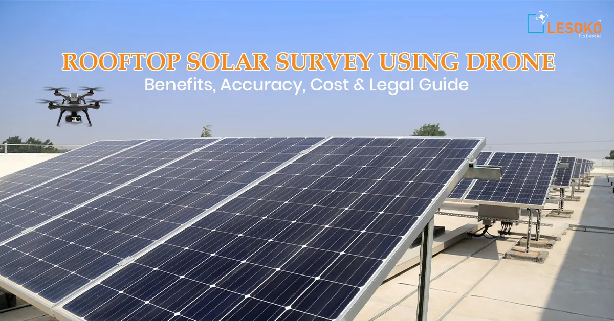
The demand for rooftop solar survey using drone technology is growing very fast. Solar companies are looking for quicker and safer ways to check rooftops. Did you know that drone inspections can reduce survey time by up to 60% compared to traditional manual methods? Many solar installers still use ladders and take measurements by hand. This method can be risky, time-consuming, and sometimes inaccurate. Because of this, project approvals can get delayed, and the solar system design may not be correct.
We will explain how drone surveys are changing rooftop solar planning. Drones help in accurate aerial mapping, shading analysis, and better decision-making using data. Whether you are a solar installer, EPC professional, or a property owner planning to install solar panels, you will learn how drones improve accuracy, lower costs, and complete projects faster. By the end, Why drone technology is becoming an important tool in modern solar projects.
What is a Rooftop Solar Survey Using a Drone?
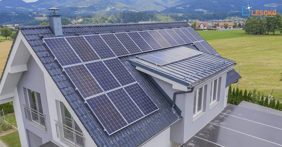
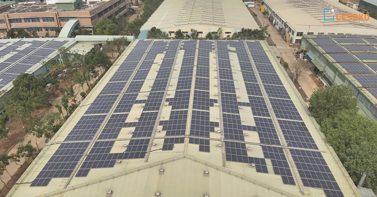
A rooftop solar survey using a drone is a modern way to check if a building’s roof is suitable for installing solar panels. Instead of climbing onto the roof to measure its size, slope, and obstacles, engineers use a drone (a small flying machine without a pilot) to take clear pictures and measurements from the air. This method is faster and safer. Drones have special cameras that capture high-quality images. These images are used to create 2D maps and 3D models of the roof with the help of computer software. This helps engineers plan where to place the solar panels and check if there are any shadows from nearby buildings or trees.
Many solar companies use drones because they save time and reduce risks. However, engineers still need to check the building in person to make sure the roof is strong enough to hold the solar panels. In short, a drone-based rooftop solar survey makes the process easier, safer, and more accurate, and helps companies give better plans to their customers.
How accurate are drone surveys for rooftop solar installation
Drone surveys are very accurate when they are done properly. For rooftop solar installation, the accuracy depends on things like good GPS signals, clear photos, and proper flight planning. When all these steps are followed, drone images can give measurements that are accurate up to a few centimeters. This is good enough for planning where to place solar panels.
Many professionals use RTK drones, which are more accurate than normal GPS drones. Special software like Pix4Dmapper and Agisoft Metashape is used to turn drone photos into detailed maps and 3D models. These maps help solar designers plan better and reduce mistakes.
Experts say that drone surveys make planning faster and more efficient. However, drones cannot do everything. Things like checking the strength of the roof, electrical connections, and roof condition still need a physical inspection. Weather conditions like strong winds or very bright sunlight can also affect the quality of the images. Drone surveys are very useful for planning rooftop solar projects, but they should be used along with proper engineering checks.
What data can drones collect for solar feasibility analysis
Drones can collect different types of data to check if a roof is suitable for installing solar panels. They take high-quality pictures, create 3D models of the roof, make elevation maps, and show how shadows fall on the roof. This helps engineers understand the size of the roof, its direction, slope, and any objects like water tanks or AC units that may block sunlight.
With the help of special software, drone images can be turned into detailed maps called orthomosaic maps. These maps help in planning where to place the solar panels. Many solar companies use this data in design software like PVsyst or Helioscope to calculate how much electricity the system can produce and how shading might reduce energy output.
Research from NREL (National Renewable Energy Laboratory) shows that accurate site modeling is important to reduce mistakes in predicting solar energy production. However, drones cannot check the electrical wiring or the strength of the roof. So, engineers still need to visit the site for manual inspection before giving final approval. From practical experience, using both drone data and ground surveys gives the best results. This method saves time, improves safety, and helps companies give correct information about system performance to customers.
Is drone surveying safe and legal for solar projects in India?
Drone surveying in India is legal for solar projects if the rules made by the Directorate General of Civil Aviation (DGCA) are followed. The Digital Sky platform manages drone permissions, flying zones, and pilot licenses. People who do rooftop surveys must use registered drones with a valid UIN number and have a licensed remote pilot.
One of the biggest benefits of drone surveys is safety. Instead of climbing high or unsafe rooftops, surveyors can collect information from the ground using drones. This reduces the risk of falls and accidents. It is also important to keep a safe distance from people, avoid restricted areas, and check the drone properly before flying.
The DGCA has clear safety guidelines. These include using geofencing, flying within height limits, and keeping the drone in visual line-of-sight at all times. In cities like Chennai and Bangalore, some areas are marked as red or yellow zones. Special permission is needed to fly drones in these areas. If companies do not follow these rules, they may face fines or delays. Following the law helps companies gain trust from clients and property owners. Before flying a drone, it is important to check local permissions and inform the concerned people. When done properly, drone surveying is a safe, fast, and legal way to survey rooftops for solar projects in India.
How much time and cost does a drone solar survey save?
Drone solar surveys save a lot of time and money compared to normal rooftop inspections. In big buildings, checking and measuring the roof by hand can take many hours or even more than one visit. But with a well-planned drone flight, the same information can be collected in just 15–30 minutes.
Drones help reduce labor work and speed up the design process. Solar companies can prepare proposals faster, which helps them win more projects. Many studies show that digital surveys reduce mistakes that happen because of wrong manual measurements. This also avoids costly redesign work. Software tools like Drone Deploy and Pix4D help combine drone images and create measurements quickly. This allows engineers to start planning the solar panel layout almost immediately. However, companies must still spend money on buying drones, software subscriptions, and training certified drone pilots.
Experts say that drone data should be checked again from the ground to avoid installation errors. Even though drones save a lot of time, physical inspection of the building is still important. Overall, the biggest benefits are faster decision-making, lower costs, and better customer understanding because visual reports clearly show the solar panel design.
Which drones and software are best for rooftop solar mapping?
Choosing the Right Drone and Software for Rooftop Solar Mapping
1. Importance of Selecting the Right Tools
Choosing the right drone and software is very important for creating accurate rooftop solar maps. Good equipment helps engineers collect correct data and avoid design mistakes.
2. Popular Drones for Solar Projects
In professional solar projects, commonly used drones include:
- DJI Air Series
- DJI Mavic Enterprise
- RTK Drones
These drones are preferred because they fly steadily and have high-quality cameras. RTK drones provide higher location accuracy, which is useful for large industrial or factory rooftops.
3. Software Used for Mapping and Design
Drone images are processed using mapping software such as:
- Pix4D
- DroneDeploy
- DJI Terra
These programs create detailed maps and 3D models. The output can then be used in solar design software like:
- Helioscope
- AutoCAD
This helps engineers plan the correct placement of solar panels.
4. Choosing Based on Project Size
- Large industrial rooftops: RTK drones are recommended for better accuracy.
- Small residential houses: Mid-range drones are usually enough and more affordable.
Expensive drones are not always necessary for smaller projects.
5. Industry Recommendations
Organizations like NREL (National Renewable Energy Laboratory) support the use of digital tools because they improve design accuracy and reduce mistakes.
6. Final Recommendation
Start with trusted and widely used drones and software. Choose tools that match your team’s skills and project size. Reliable equipment helps solar engineers collect accurate data and plan installations properly.
Can drones detect shading issues for solar panel placement?
Yes, drones can help find shading problems when planning where to place solar panels. Drones take clear pictures from above. These pictures show nearby buildings, trees, water tanks, or other objects that can block sunlight. Special software turns these pictures into 3D models. Engineers can then study how shadows fall on the roof at different times of the day and in different seasons. This helps in choosing the best place and angle to fix the solar panels. Shading is important because even a small shadow on one panel can reduce the total electricity produced by the system.
Research organizations like NREL say that correct site planning improves solar panel performance. However, drones cannot measure the exact amount of sunlight at that moment. For very accurate results, extra tools and on-site checks may also be needed.
What are the challenges of drone-based rooftop inspections?
Drone-based rooftop inspections have many benefits, but they also have some challenges. One major problem is weather. Strong winds, rain, or very bright sunlight can make it difficult for the drone to fly properly and take clear pictures. This can affect the accuracy of the data collected.
In cities, there are more difficulties. Signal problems, no-fly zones, and obstacles like buildings and power lines make flying harder. In India, according to DGCA rules, drone operators must follow guidelines, avoid restricted areas, and take permission when required. Another challenge is understanding the data. Drones can take high-quality images, but these images cannot fully replace a structural engineer’s inspection. Depending only on drone images without checking the site physically can sometimes cause mistakes in design.
Processing the data is also time-consuming. Large amounts of data need powerful computers and trained people to create accurate models. Organizations like NREL suggest using proper and standard methods for better planning of solar projects. Drone inspections are very useful, but they should be used along with manual inspections, following rules and expert guidance for best results.
How does drone surveying improve solar project ROI?
Drone surveying improves solar project ROI (Return on Investment) by reducing mistakes, saving time, and increasing customer trust. In traditional methods, wrong measurements can cause design changes, extra costs, and delays in installation. Drone maps give accurate measurements, which help engineers design better solar panel layouts from the beginning.
From practical EPC experience, faster surveys help companies send proposals more quickly. This increases the chances of getting the project because customers receive clear visual reports that show how the solar system will look on their rooftop. Seeing clear images builds trust and helps customers make decisions faster. Organizations like the International Energy Agency say that using digital technology helps reduce solar project costs worldwide. Drones reduce manual work and the need for many site visits. This helps companies use their time and workers more efficiently.
However, better ROI depends on using drones properly. Companies need trained and certified drone pilots and good software. If companies start using drones without proper planning and systems, they may not get the expected benefits. When used correctly, drone surveys improve accuracy, reduce risks, and increase long-term profits for solar installation companies.
Workflow of a Professional Rooftop Solar Drone Survey
A professional rooftop solar drone survey follows a step-by-step process to ensure safety, accuracy, and proper planning.
1. Pre-Survey Planning
- Check DGCA flight permissions and local regulations
- Study the project site and surrounding area
- Identify no-fly or restricted zones
- Plan the drone flight path using mission planning software
- Ensure drone battery, camera, and GPS systems are ready
This stage ensures the survey is safe and legally compliant.
2. Drone Flight & Data Collection
- Fly the drone over the rooftop at a fixed height
- Capture high-resolution images from multiple angles
- Maintain proper image overlap (usually 70–80%)
- Keep the drone in visual line-of-sight
- Monitor weather conditions for safe operation
This step collects the raw data needed for mapping and analysis.
3. Data Processing & Mapping
- Upload images into software like Pix4D or DroneDeploy
- Generate orthomosaic maps
- Create 3D rooftop models
- Develop elevation and contour data
These outputs help in accurate rooftop measurement and layout planning.
4. Solar Design & Shading Analysis
- Import drone maps into solar design software (Helioscope, PVsyst, etc.)
- Plan solar panel placement
- Analyze shading from nearby buildings or objects
- Estimate energy production
This stage converts survey data into a workable solar system design.
5. Physical Site Inspection
- Inspect roof strength and structure
- Check roof condition and material
- Verify electrical access points
- Confirm safety for installation
Drone data supports planning, but physical inspection ensures safety and final approval.
6. Reporting & Documentation
- Prepare survey reports
- Include maps, 3D models, and shading analysis
- Share visual proposals with clients
- Maintain proper project documentation
Clear reporting builds trust and supports professional service delivery.
A structured workflow ensures:
- Higher accuracy
- Better safety compliance
- Faster project approvals
- Reduced design errors
Using both drone surveys and on-site inspection gives the best results for rooftop solar projects.
Drone technology is reshaping how rooftop solar projects are planned, inspected, and executed. From improving safety to delivering highly accurate measurements, a Rooftop Solar Survey using Drone helps both installers and property owners make smarter decisions before installation begins. While drones cannot completely replace on-site engineering assessments, they provide powerful visual insights that streamline planning and reduce costly mistakes.
Every rooftop is different, and real-world experiences often reveal insights that no guide can fully cover. Have you used drone surveys for solar projects, or are you planning to adopt this technology soon? Share your experiences, challenges, or questions. Your perspective could help other readers understand practical benefits and avoid common mistakes. Let’s build a knowledgeable community by learning from each other’s solar journey.
Frequently Asked Questions
1. What is a Rooftop Solar Survey using a Drone?
A Rooftop Solar Survey using a Drone is a modern way to check a roof using a flying device called a drone. The drone takes pictures from above to study the roof size, direction, and shading. Instead of measuring the roof by hand, the drone creates clear maps and 3D models. This helps solar engineers plan where to place solar panels. It is also safer because workers do not need to climb onto the roof. Many companies use special software to turn drone images into solar project reports.
2. How accurate is drone surveying for solar installations?
Drone surveys can be very accurate if the flight is planned properly and good equipment is used. Some advanced drones give very exact location data, which helps in correct roof measurements. However, drones only capture images and measurements. The strength of the roof must still be checked by visiting the site. Using both drone surveys and physical inspection gives the best results.
3. Is drone surveying legal for rooftop solar projects in India?
Yes, drone surveying is legal in India if companies follow DGCA rules and use registered drones. In some areas, especially cities, special permission may be needed. The drone pilot must follow safety rules and height limits. Companies should always check the Digital Sky platform before flying a drone to avoid problems or fines.
4. What data do drones collect during solar surveys?
Drones collect clear maps, roof measurements, height details, and inspection photos. This information helps engineers study shading, find obstacles, and design the best panel layout. Many companies use this data in solar design software to estimate energy production. However, electrical and structural checks still need to be done at the site.
5. How do drones help with shading analysis?
Shading can reduce solar panel performance. Drone-made 3D models help engineers see how sunlight moves and where shadows fall on the roof. This helps them place panels in the best position to avoid energy loss. Using drone data with solar software improves system performance and efficiency.
6. What are the main benefits of using drones for rooftop surveys?
Drones make surveys faster and safer. They give accurate measurements and clear visual reports. Workers do not need to climb roofs, which reduces risk. Drone surveys also help companies prepare proposals quickly, improving customer trust and saving time.
7. Are drone surveys expensive compared to traditional methods?
Buying drones and software may cost more at first. But in the long run, they save money. Faster surveys reduce labor costs and prevent mistakes in design. For large projects, drone surveys save time and improve work efficiency. Even small home projects benefit when survey time is short.
8. Can drones completely replace manual rooftop inspections?
No, drones cannot fully replace manual inspections. They are helpful tools but cannot check everything. Roof strength, wiring, and safety must still be checked in person by experts. The best method is to use both drone surveys and physical inspections for safe and accurate solar installation.