Why Drone-as-a-Service (DaaS) Is Transforming India Right Now
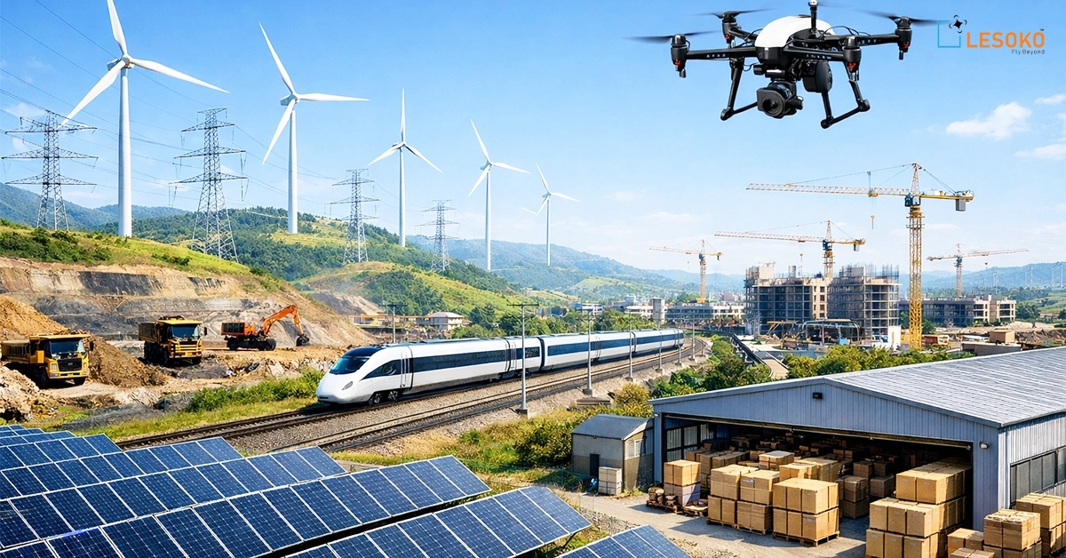
India is building at an unprecedented scale—solar parks spanning thousands of acres, high-voltage transmission corridors crossing states, smart cities reshaping urban life, and mines operating deeper and wider than ever before. But with scale comes complexity, risk, and cost. Traditional surveying, inspection, and monitoring methods are slow, expensive, and often dangerous.
Drone-as-a-Service (DaaS) in India can help with that.
Organizations can now subscribe to drone solutions on demand, receive precise data, actionable insights, and measurable ROI without operational overhead, rather than purchasing drones, training pilots, maintaining hardware, and managing data pipelines. Lesoko Technologies, a full-stack drone company based in Chennai that provides end-to-end aerial intelligence across industries, is at the center of this transformation.
This article investigates:
- The true meaning of Drone-as-a-Service in the Indian context and the reasons behind the rapid adoption of DaaS across industries
- How Lesoko provides superior accuracy, security, and financial savings
- Practical uses, advantages, and prospects for the future
This will show why DaaS is now necessary if you oversee projects related to infrastructure, renewable energy, mining, railroads, or the public sector.
Drone-as-a-Service (DaaS): What Is It? A Simple Yet Powerful Model
Drone-as-a-Service (DaaS) is a project-based or subscription-based delivery model in which companies contract with specialized providers like Lesoko to handle drone operations, data collection, analytics, and reporting.
Instead of owning drones, clients gain access to:
- Certified pilots and domain experts
- Advanced drone fleets (RTK, LiDAR, thermal, night-vision)
- AI-driven analytics systems
- Reports and dashboards ideal for the industry
Think of it like cloud computing—but for aerial intelligence.
Why Drone-as-a-Service Is Booming in India
India’s DaaS adoption isn’t accidental—it’s driven by real operational needs and policy support.
Key Growth Drivers
- Large-scale infrastructure development, including smart cities, railroads, highways, and renewable energy
- DGCA-regulated drone ecosystem enhancing safety and compliance
- Cost pressure to complete projects more quickly and affordably
- Safety issues during risky inspections
- Demand for highly accurate, real-time data
According to industry forecasts, the drone market in India will grow at a 25–30% CAGR, with services making up the largest share. Businesses want results, not gadgets. DaaS provides precisely that.
Lesoko Technologies: Redefining Drone-as-a-Service in India
Lesoko Technologies is not just a drone operator—it’s a full-stack aerial intelligence partner. Based in Chennai, Lesoko delivers end-to-end drone solutions—from precision data capture to advanced processing, analytics, and actionable insights—across:
- Renewable energy
- Infrastructure & utilities
- Mining & oil & gas
- Agriculture
- Government & public sector
Proven at Scale
- 2.2+ lakh safe flights
- 34+ GW solar assets inspected
- 2.3+ lakh hectares surveyed
- ₹10+ crore saved in operational costs
This isn’t experimentation. It’s execution at national scale.
Numbers That Define Lesoko’s Excellence
Data tells the real story. Here’s what Lesoko’s Drone-as-a-Service has already delivered:
- 5.1 GW solar projects inspected
- 2,00,000 safe flights
- 95,000 hectares land surveyed
- ₹53 million saved in monitoring costs
- 9,700 rooftop surveys completed
- 3,000 km transmission lines inspected
- 1 cm-level accuracy achieved
- 99.3% survey precision rate
These numbers highlight one thing clearly: precision at scale.
Lesoko’s All-Inclusive Drone-as-a-Service Solutions
Lesoko’s DaaS portfolio is built around six core offerings, designed to cover the full lifecycle of assets and projects.
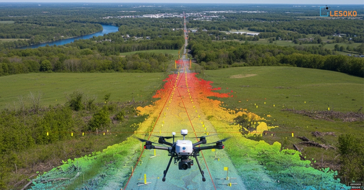
1. Precision Topographic & LiDAR Surveys
Lesoko uses LiDAR, RTK, and DGPS to provide centimeter-level terrain intelligence.
Applications include:
- Generation of DSM and DTM
- Mapping contours
- Route and corridor planning
- Clearance and slope analysis
These surveys significantly reduce design errors and rework, making them ideal for solar farms, transmission corridors, mining sites, and major infrastructure projects.
2. Aerial Thermal & Visual Inspections
Lesoko detects flaws that are invisible to the human eye using AI-driven thermal and RGB imaging.
Inspection coverage:
- Solar PV hotspots and diode failures
- Wind turbine blade cracks and erosion
- Transmission tower components
- Railway OHE systems
Longer asset life, less downtime, and predictive maintenance are all benefits of early detection.
3. Volumetric & Stockpile Analysis
Accurate volume data is vital for mining and construction projects, and Lesoko provides it with unbeatable speed.
Capabilities include:
- Stockpile measurement
- Cut & fill analysis
- Dump height and slope stability
- Tracking the progress of excavation
Drone-based volumetrics are substantially more accurate and 70 times faster than traditional surveys.
4. Infrastructure Monitoring & Asset Mapping
Continuous visibility across linear and complex assets is made possible by Lesoko.
Key use cases:
- Substations and power lines
- Rail tracks and pipelines
- Civil structures and bridges
Digital twins, vegetation encroachment analysis, and component-level asset cataloguing—all essential for long-term asset management—are among the deliverables.
5. 24/7 Security & Surveillance
For high-value assets like solar parks and industrial facilities, Lesoko provides round-the-clock aerial security.
Features:
- Real-time streaming
- Night-vision monitoring
- Alerts about intrusions and wildlife
- Quick reaction to incidents
This significantly lowers unauthorized access, theft, and vandalism.
6. AI-Powered Data Analytics & Reporting
Data is only valuable when it drives decisions. Lesoko’s cloud-based dashboards offer:
- Defect detection in real time
- Monitoring ROI and progress
- Reports generated automatically
- Stakeholder-specific KPIs
Every insight is available anywhere, at any time.
Industry-Specific Applications of Drone-as-a-Service in India
Solar Rooftop Survey
Solar rooftop surveys determine a building’s technical and economic suitability for solar installation. Detailed feasibility studies covering roof dimensions, structural condition, tilt, orientation, and available shadow-free area are carried out using drones. Precise solar PV module measurements, shadow analysis, and high-accuracy 2D/3D drawings aid in the design of ideal system layouts, minimize installation errors, and maximize energy production while ensuring long-term system performance.
Ground Mount Solar Survey
Drones and RTK/LiDAR technology are used in ground-mounted solar surveys to conduct a thorough topographical analysis of large land parcels. This includes precise land profiling to enable optimal panel placement, mapping of land contours, and profiling of slopes and gradients. Accurate measurements of solar PV modules and terrain modeling facilitate effective design layouts, reduce the cost of earthwork, enhance drainage planning, and ensure increased plant efficiency and quicker project completion.
Solar Panel Inspection
Thermal and visual imaging are used in drone-based solar panel inspection to find hidden flaws that impact plant performance. While high-resolution RGB imagery finds physical damage, soiling, and incorrect alignment, thermal inspections find hotspots, broken diodes, and defective modules. Early fault detection, lower risks associated with manual inspection, energy loss prevention, and predictive maintenance for better assets are all made possible by solar plant thermography.
Solar Project Progress Monitoring
Real-time visibility into daily construction activities is made possible by drone-enabled progress monitoring. Using geotagged aerial photos, it monitors labor deployment, machinery use, and project progress by block or section. Anomalies, plan deviations, and illegal site activity can all be found with the aid of AI-based analytics. Through the course of the project, this ensures transparency, enhances stakeholder coordination, minimizes delays, and facilitates data-driven decision-making.
Night Surveillance for Solar Plants
Drones with thermal sensors, night-vision cameras, and real-time monitoring improve security at solar installations. Unauthorized entry, wildlife intrusion, theft attempts, and suspicious movement throughout the site are among the anomalies it detects. Particularly in remote or large-scale solar facilities, automated alerts and site patrolling enhance response times, lower asset losses, and ensure continuous plant operations.
Drone Technology for Monitoring and Managing Infrastructure Projects
Infrastructure Survey, Mapping & Planning
GIS and LiDAR-driven mapping for urban and regional planning are supported by drone-based infrastructure surveys. Topographical surveys, land-use and land-plan analysis, tree counting, corridor mapping, intrusion detection, and cadastral map overlays are among the services offered. With precise, current spatial intelligence, economic household surveys and spatial zone identification support smart city planning, site selection, and sustainable urban development.
Infrastructure Project Monitoring & Management
By tracking construction progress against schedules and SOPs, drone-powered monitoring guarantees efficient infrastructure project execution. Frequent aerial data aids in the early detection of possible hazards, deviations, and obstacles. Stakeholders can effectively manage complex projects while reducing cost overruns and execution delays thanks to high-resolution visuals and analytical reports that support improved coordination, quality control, and compliance.
AI-Driven Drone Inspection for Mining Operations
Mining Surveying & Mapping
Mining surveys use drones and LiDAR to deliver accurate topographical maps, volumetric estimations, and digital mine models. These services support physical verification of stockpiles, dump height and slope measurement, settlement mapping, and infrastructure planning. Digitization of mining data improves operational visibility, supports regulatory compliance, enhances safety planning, and optimizes extraction strategies across mining sites.
Mining Inspection & Monitoring
Drones and LiDAR are used in mining surveys to provide precise topographical maps, volumetric estimates, and digital mine models. Infrastructure planning, settlement mapping, dump height and slope measurement, and physical stockpile verification are all supported by these services. Digitization of mining data enhances safety planning, supports regulatory compliance, improves operational visibility, and maximizes extraction strategies across mining sites.
Mining Project Monitoring
Mines and quarries can be continuously monitored with little risk to people thanks to drone-based mining inspections. Stockpile geotagging, haul road optimization, asset inspection, ambient air quality monitoring, and blasting zone safety surveillance are among the services offered. In addition to increasing productivity and ensuring environmentally responsible mining operations, subsidence monitoring and real-time site visibility also help prevent accidents.
Railway Drone Services
In addition to surveying and mapping rail corridors, drone services for railroads include OHE and catenary line inspections. Without interfering with train operations, high-resolution imagery aids in the detection of structural flaws, alignment problems, and component wear. For large and complex railway networks, these inspections facilitate quicker decision-making, increase maintenance efficiency, lower manual risks, and improve safety.
Drone-Based Transmission Line Survey, Inspection & Monitoring Services
Transmission Line Tower Inspection
Drone-based transmission tower inspections offer an extensive assessment of substations, switchyards, spans, and componentry. Analysis of vegetation encroachment finds clearance infractions that could result in outages. Faster inspections, enhanced safety, decreased downtime, and proactive maintenance across lengthy transmission corridors and high-risk environments are made possible by high-resolution visuals and thermal data.
Transmission Route Alignment Survey
Drone-based topographical mapping is used in route alignment surveys to determine the best transmission routes. Route identification, terrain analysis, and the identification of encroachments or unapproved construction are among the services offered. Precise aerial data minimizes environmental impact, expedites approval and construction procedures, minimizes land acquisition problems, and optimizes alignment choices.
Transmission LiDAR Survey
For transmission lines, LiDAR surveys provide extremely precise phase-to-phase, phase-to-ground, and clearance measurements. Ensuring regulatory compliance, identifying sag and clearance risks, and enhancing line safety all depend on this data. LiDAR supports dependable and effective power transmission planning by enabling accurate modeling even in areas with thick vegetation or uneven terrain.
Transmission Project Monitoring
Construction milestones like foundation work, tower erection, and site infrastructure development are tracked by drone-based project monitoring. Frequent aerial updates offer real-time visibility into installation status, access road conditions, and progress. This guarantees that projects remain in line with deadlines and quality standards, improves coordination, and cuts down on delays.
Drones for Wind Turbine Inspection, Survey, and Monitoring
Wind Blade Inspection
Drones are used in wind blade inspections to precisely identify erosion, cracks, and damage from lightning strikes. By removing the need for rope access or shutdowns, close-up imagery increases safety and decreases downtime. Early defect detection extends blade life, aids in maintaining optimal turbine performance, and supports predictive maintenance.
Wind Survey & Planning
Drone-enabled wind surveys evaluate the environmental impact, access routes, terrain conditions, and land viability. Efficient infrastructure planning and turbine placement are supported by topographical and zoning assessments. Precise aerial information lowers planning risks, enhances logistical choices, and guarantees adherence to land-use and environmental laws
Wind Project Monitoring
Construction milestones such as foundation work, tower erection, turbine installation, and site infrastructure development are tracked by wind project monitoring. Drone visuals facilitate early problem detection, enhance coordination, and give stakeholders precise progress insights. This guarantees project completion on schedule while upholding cost-effectiveness, quality, and safety.
Why Choose Lesoko for Drone-as-a-Service in India
Lesoko stands out in a crowded market because of execution excellence.
Industry-Leading Advantages
- Precision Excellence: 1 cm accuracy, 99.3% precision
- Safety First: Zero crashes across 500,000+ flights
- Cost Optimization: ₹53 million saved, 80% downtime reduction
- End-to-End Solutions: From flight to insight
- Advanced Analytics: AI-powered dashboards
- Rapid Deployment: On-site within 24–48 hours across India
Trusted by Industry Leaders
Lesoko’s clientele includes:
- Larsen & Toubro
- Tata Power
- Adani Group
- Indian Railways
- Coal India
- Reliance
- SECI, WBREDA, BREDA, MEDA
Trust is earned through performance—and Lesoko has proven it repeatedly.
The Future of Drone-as-a-Service in India Is Here
The Future of Drone-as-a-Service in India Drone-as-a-Service is now a vital capability for India’s fastest-growing industries, not just a futuristic idea. DaaS enables businesses to create smarter, safer, and faster projects by removing risk, cutting costs, and speeding up insights.
Lesoko Technologies is establishing the standard for Drone-as-a-Service in India with its full-stack capabilities, demonstrated scale, and unwavering focus on accuracy and safety. The sky is now the beginning rather than the end if your operations require precision, speed, and quantifiable return on investment.
Ready to See Lesoko’s DaaS in Action? Book a Demo
📞 Call: +91 98403 98883
📧 Email: sales@lesoko.in
⏰ Response Time: Within 24 hours