VOLUMETRIC SURVEY & MEASUREMENT
Volumetric survey & measurement in
India
Drone-based stockpile, excavation and cut-fill volumes for mines, quarries and project sites across India. You are not buying a drone survey. You are buying a number, with the reference surface, validation and evidence behind it.
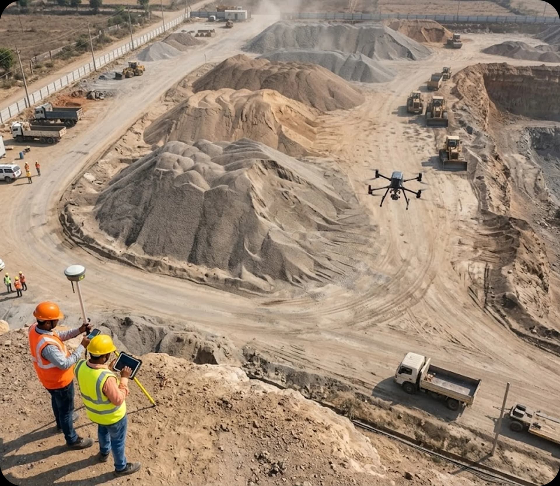
Mining
Project Experience3D
Volume MeasurementStockpiles
Volume AssessmentReports
Documented OutputsDefined
Reference SurfaceIN SHORT
What is a volumetric survey?
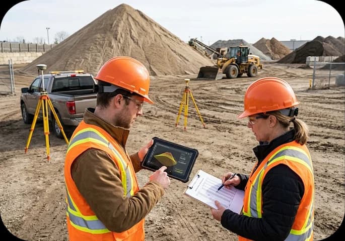
It measures how much material sits above, or has been removed below, an agreed reference surface inside a defined boundary. Lesoko captures the surface by drone, calculates the volume, validates it against control and delivers the quantity with the evidence needed to use it in an inventory, a quantity register or a reconciliation.
THE PROBLEM
Why booked stock and physical stock drift apart
Where stock is measured from DGPS or total-station points, a few points per pile can miss craters and steep faces, and walking an unstable pile is a safety risk. The result can be stale inventory, reconciliation gaps and quantity disputes.
Inventory you cannot trust
Booked stock and physical stock disagree, and nobody can say by how much.
Quantities that get disputed
Excavation and cut-fill numbers feed payments. An undefined base surface invites argument.
Slow, risky ground survey
Foot access to steep piles, benches and active areas costs time and adds exposure.
WHAT WE MEASURE
The measurement jobs a volumetric survey covers
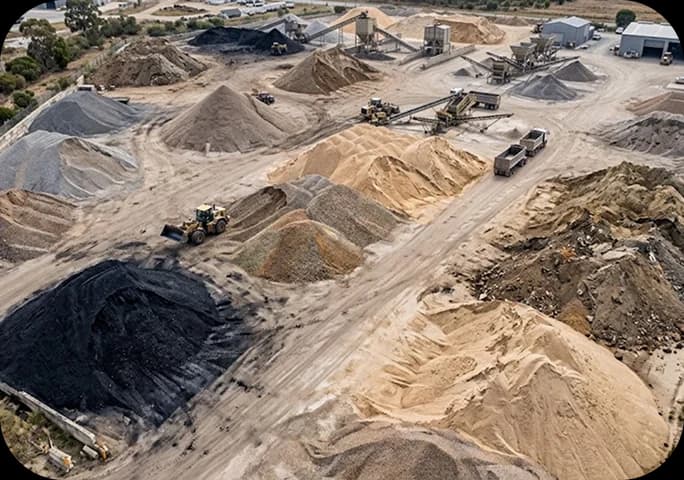
Stockpile volume
Coal, aggregates, sand, gravel, overburden and other open-yard material, pile by pile.
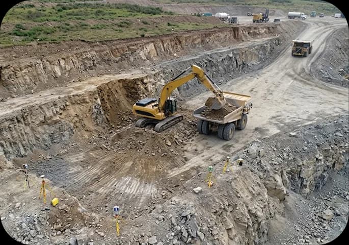
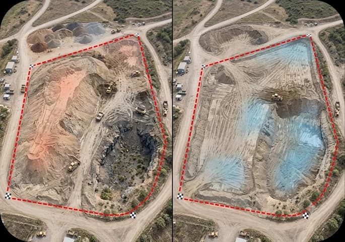
Excavation volume
Material removed from a pit or bench against a prior surface or design level.
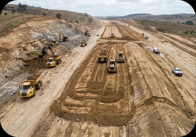
Cut & fill
Earthwork and bund-cut quantities against a design or ground level.
Material movement
Change between two surveys on the same datum, boundary and method.
Quantity verification
Measured volume checked against reported or booked quantity.
HOW THE NUMBER IS PRODUCED
How a volume is produced, from requirement to validation
The steps below show what happens between capture and the final figure, because that is where a measurement becomes defensible.
What decision will the number support: inventory, payment, planning or audit? That sets the tolerance.
Where the pile starts. Toe lines, touching piles, wall-adjacent material and exclusions are marked and reviewed.
Pad, prior survey, design level or marked ground level, agreed in writing before calculation.
Ground control and RTK positioning tie the dataset to a coordinate system; repeat surveys reuse it.
Flights planned to the site and the tolerance, by DGCA-certified pilots, under site and airspace permissions.
Photogrammetry processing produces the orthomosaic, point cloud and elevation model used for volume.
Volume computed per pile or zone: cut, fill and net where relevant.
Checkpoint comparison, boundary and base review, and a final check before release.
TECHNICAL CONFIDENCE
For the quantity that has to stand up to review
How the surface is positioned, captured and reconstructed
Aircraft, sensor and processing software are confirmed at scoping against the tolerance the number must meet. Image resolution sets surface detail; it does not by itself set volume accuracy.
LESOKO EVIDENCE
Volumes measured on Lesoko mining and bund-cut projects
Figures below come from Lesoko project reports. Each shows what was measured, not a promised accuracy.
| PROJECT | MEASURED | VOLUME | REPORTED DETAIL |
|---|---|---|---|
| Mine pit excavation | Total excavated volume, about 2.23 acres (≈9,025 m²) | 73,792.621 m³ | DEM-based, with haulage road mapped |
| Tilaswan bund / mountain cut | 5,600 m² footprint, two reference levels | 29,682 / 55,417 m³ | Options shown on orthomosaic and elevation model |
| Satna, Madhya Pradesh: bund 1 | Sand & gravel | 475.63 m³ | 722.9937 t reported |
| Satna: bund 2 | Sand & gravel | 441.23 m³ | 670.681 t reported |
| Satna: bund 3 | Sand & gravel | 13.40 m³ | 20.37091 t reported |
| Stockpile 1 / Stockpile 2 | 446.589 m² / 1,404.71 m² footprints | 555.022 / 4,224.12 m³ | Per-pile DEM volumes |
Satna report LESMIN22#002 also maps haul-road width and gradient and overall site features. Tonnage figures are as reported; the density basis is agreed per project.
WHAT YOU RECEIVE
Deliverables: the quantity, the evidence and the data behind it
Verified quantity
Per-pile or per-zone volume table (m³), with tonnage where density is agreed
Used for: Inventory, quantity register, reconciliation
Measurement evidence
Annotated boundaries, reference level, cut/fill maps, change maps
Used for: Review, sign-off, disputes
Spatial data
Orthomosaic, point cloud, DEM/DTM, contours
Used for: Planning, CAD and GIS work
Documentation
Method note, control and QA summary, stated assumptions
Used for: Audit trail and repeat surveys
File formats and coordinate system are agreed at scoping.
RECURRING MEASUREMENT
Repeat surveys for tracking material movement
One survey gives a stock position. Repeat surveys give movement. Month-to-month comparison only holds if control, boundaries and reference rules stay fixed, so we set them once and reuse them. Choose a one-time survey, a periodic cycle (for example monthly) or a site-specific schedule at scoping.
WHERE IT APPLIES
Mines, quarries, earthworks and industrial yards
Mining
Stockpiles, pit excavation, overburden and haul-road context.
Quarries
Aggregate and sand inventories, bench and bund cuts.
Construction & earthwork
Cut and fill, bund removal, borrow and spoil quantities. For progress tracking, see construction & project monitoring.
Industrial yards
Open bulk-material yards needing periodic physical verification.
FAQ
Questions?
We've Got Answers
Everything you need to know about working with Lesoko. Can't find what you're looking for?
Contact SupportRequest Inspection
Get a scoped quote for your asset
We'll return a proposal with scope, methodology, deliverables, timeline and commercial terms clearly laid out.
- DGCA-compliant flight, scheduled around your operating hours
- Severity-graded report within a 24-48hr target
- Raw data included